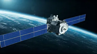


Pioneering Space-Based AI
The ambition to train artificial intelligence models directly in space is no longer science fiction. A groundbreaking collaboration between space-tech
firm Pixxel and AI solutions provider Sarvam AI is set to bring India's first orbital data centre satellite, dubbed 'The Pathfinder,' to life. This ambitious project, slated for a late 2026 launch, aims to house powerful graphics processing units (GPUs) on a 200-kg satellite, enabling the training and inference of Sarvam's sophisticated AI models in the unique environment of orbit. Unlike traditional satellite computing, which often uses less powerful, survival-optimized processors, Pathfinder will feature hardware comparable to that found in terrestrial data centres, designed specifically to handle the demands of cutting-edge AI. This move aligns with a global trend where major tech players are exploring space to overcome Earth's energy constraints and environmental concerns associated with massive data centres, which are projected to consume significant amounts of power globally and within India.
Addressing Earth's Limits
The sheer energy consumption of traditional data centres on Earth has become a significant point of contention, driving innovation towards alternative solutions. With global data centre capacity expected to soar to 200 GW by 2030 and India's capacity projected to grow six-fold to 10.5 GW by 2031, the demand for power is immense. This escalating energy requirement is not only leading to public resistance but is also compelling tech companies to seek unconventional approaches, such as orbital data centres. Initiatives like this aim to leverage the abundant solar energy available in space, operating compute resources closer to where space-based data is generated. This forward-thinking strategy seeks to circumvent some of the inherent limitations faced by ground-based infrastructure, including power availability and the environmental impact of energy-intensive operations. Even governmental bodies like ISRO are exploring advanced satellite capabilities with integrated data processing and storage, signaling a broader recognition of the potential for space-based computing.
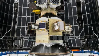
Partnership in Action
The strategic alliance between Pixxel and Sarvam AI defines clear roles for the development and deployment of 'The Pathfinder' satellite. Pixxel will be responsible for the comprehensive lifecycle of the satellite, encompassing its design, construction, launch, and ongoing operation. The satellite's development will take place at Pixxel's expansive Gigapixxel facility, which is being scaled to accommodate the production of up to 100 satellites. While specific technical details of Pathfinder remain undisclosed, the core objective is clear: to facilitate the direct training and inference of Sarvam's advanced language models in orbit. This approach liberates the models from reliance on external cloud or ground infrastructure, fostering greater autonomy. Furthermore, the mission will serve as a critical validation for real-time AI inference and data processing within the demanding conditions of space, rigorously testing performance, power management, thermal regulation, and data workflow efficiency under actual operational scenarios, thereby laying the crucial groundwork for future orbital data centre systems.
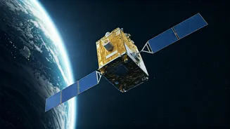
Sovereign AI Infrastructure
This ambitious undertaking is deeply rooted in the concept of establishing sovereign AI capabilities for India. By having Indian-built AI models trained and operating aboard an Indian-built satellite, the nation gains greater control over its intelligence infrastructure. This independence from foreign cloud or ground systems is a critical strategic advantage. Beyond its AI training capabilities, the Pathfinder satellite will also be equipped with a hyperspectral imaging camera. This instrument will capture high-fidelity hyperspectral data, which can then be analyzed directly in orbit by the foundation models trained onboard. This onboard processing eliminates the need to transmit vast amounts of raw imagery back to Earth, allowing for real-time pattern identification, change detection, and insight generation. Such immediate analysis significantly accelerates the decision-making process, offering faster responses for applications like environmental monitoring, resource management, and tracking critical infrastructure.