Hands-Free Navigation
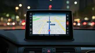
One of the most anticipated updates is the hands-free navigation feature. This functionality will allow drivers to control Google Maps using voice commands,
eliminating the need to take your hands off the steering wheel or your eyes off the road. Users can activate this feature by simply speaking commands, such as requesting directions to a specific location or selecting alternative routes. This hands-free approach not only improves convenience but also significantly enhances road safety by minimizing distractions. The voice-activated controls are designed to be intuitive and responsive, enabling seamless interaction with the map application while you focus on driving. This is particularly beneficial in congested traffic situations where quick adjustments and constant navigation are necessary, making it easier to stay on course without compromising safety.
Accident-Prone Area Alerts
Safety takes center stage with the introduction of accident-prone area alerts. This feature provides timely warnings about zones known for higher accident rates. Google Maps analyzes data, including accident reports and user feedback, to pinpoint these dangerous areas. Before you enter an area identified as prone to accidents, the app will issue a notification, prompting you to exercise extra caution. This proactive approach allows drivers to adjust their speed, pay more attention, and potentially avoid hazardous situations. This feature is particularly crucial on Indian roads where traffic conditions and road quality can vary greatly. The alerts are dynamic and updated regularly based on real-time data, thus ensuring the most current safety information is always available to drivers. This feature significantly enhances driver awareness, allowing for a safer navigation experience.
Improved Route Optimization
Route optimization is another key enhancement coming to Google Maps. The application will leverage real-time traffic data, historical traffic patterns, and user feedback to recommend the most efficient routes. This upgrade goes beyond just finding the shortest distance; it considers factors like road conditions, toll roads, and expected delays to provide the fastest and most convenient journey. By analyzing data on current and predicted traffic situations, Google Maps aims to minimize travel time and reduce stress during commutes. The system continually adapts to changing road conditions, providing alternative routes if traffic builds up or unforeseen incidents occur. This enhanced route optimization helps users save time, conserve fuel, and reduce the overall frustration associated with navigating through congested areas, common in many Indian cities.
Enhanced Public Transit Info
For those who use public transport, Google Maps is improving its integration of public transit information. This upgrade provides more detailed and accurate data about buses, trains, and other public transportation options. Users will see real-time updates on arrival times, delays, and any service disruptions, helping them plan their journeys more effectively. The improved information includes platform numbers, walking directions to stations, and the estimated duration of the entire journey. By incorporating up-to-the-minute data, Google Maps ensures that users receive the most current and reliable information, leading to more efficient and stress-free commuting experiences. This feature is very helpful in Indian cities where public transportation is a primary mode of travel.
Offline Maps Improvements
The functionality of offline maps is also getting an upgrade. Users in India, particularly those in areas with limited or unreliable internet connectivity, will benefit from the improved offline capabilities. The latest enhancements allow for more detailed map downloads and easier access to navigation features even when there is no internet connection. This is useful when traveling in remote areas or locations with poor network coverage. Users can download maps of specific areas and access turn-by-turn navigation, search for places, and view points of interest without the need for an active data connection. This offline feature ensures that navigation services are accessible in all conditions, providing consistent access to essential travel information regardless of connectivity, thus increasing overall utility and ease of use in diverse environments.


