


The Allure of the Unknown
Before the age of precise satellite navigation and extensive global exploration, the vast expanses of uncharted territories on maps were fertile ground
for speculation and legend. Explorers, often driven by tales of riches or fantastical realms, sometimes reported sightings that, upon later investigation, proved to be nonexistent. These phantom lands, fueled by a combination of the Fata Morgana optical illusion, misinterpretations of natural phenomena, and sheer wishful thinking, occupied a prominent place in geographical understanding for centuries. This fascination with the imagined was so potent that these mythical locations were widely believed to exist, influencing cartography and inspiring numerous expeditions before their eventual debunking. The stories of these non-existent places offer a glimpse into the human desire to fill the blanks and the enduring power of myth over verifiable fact.
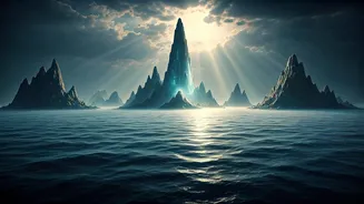
Atlantis: The Sunken Dream
Perhaps the most legendary of all non-existent lands is Atlantis, a civilization first chronicled by the ancient Greek philosopher Plato. He described it as a formidable and highly advanced island kingdom, a naval power that ultimately met its watery demise, sinking into the ocean depths. For millennia, the story of Atlantis has captured the human imagination, inspiring countless theories about its location and the possibility of discovering its submerged ruins. Despite extensive searches and a multitude of proposed sites around the globe, from the Mediterranean to the Caribbean, no conclusive evidence has ever surfaced to prove its historical reality, leaving it firmly in the realm of myth and philosophical allegory.
Bermeja: A Gulf Mirage
Appearing on navigational charts for hundreds of years, Bermeja Island was once a fixture on maps of the Gulf of Mexico. First meticulously charted by Spanish cartographers in the 1530s, it persisted on maps well into modern times. However, despite its established presence in cartographical records, modern scientific surveys, including a dedicated expedition in 2009, found absolutely no trace of land where Bermeja was supposed to be. This consistent lack of physical evidence led geographers and scientists to the definitive conclusion that Bermeja was, in fact, a phantom island, a persistent geographical anomaly that existed only on paper.
Frisland: The North Atlantic Ghost
For a considerable period, spanning the 16th and 17th centuries, Frisland was depicted on numerous maps as a substantial island located in the North Atlantic Ocean, positioned near the known territories of Iceland and Greenland. It's widely believed that the origin of Frisland lies in a combination of misidentified geographical features and possibly a contentious map attributed to the Zeno family. Regardless of its specific genesis, cartographers of the era, perhaps influenced by existing charts and accounts, continued to reproduce Frisland for generations, solidifying its place in the cartographical landscape of the time, despite its lack of any real-world counterpart.
Hy-Brasil: The Mist-Shrouded Isle
For centuries, Hy-Brasil held a place on maps as a distinct circular island, perpetually shrouded in mist, situated off the western coast of Ireland. Folklore often depicted this mythical land as a utopian paradise, accessible only under specific, rare conditions, reportedly appearing only once every seven years. Despite the romantic descriptions and its consistent inclusion by mapmakers from the 14th century through the 19th century, numerous expeditions launched to find Hy-Brasil consistently failed, underscoring its legendary status rather than its geographical reality. Its enduring presence on maps speaks to the power of folklore and the human inclination to believe in hidden paradises.
Mountains of Kong: A West African Fiction
In a departure from phantom islands, the Mountains of Kong represent a legendary mountain range purportedly located in West Africa. This supposed colossal chain was a surprisingly common feature on nearly 40 maps throughout the 19th century, becoming a widely accepted geographical landmark. However, later and more thorough explorations of the West African interior definitively proved that no such mountain range existed in the region. The persistent inclusion of the Mountains of Kong on so many maps highlights how accepted misinformation, once established, could be difficult to dislodge from geographical understanding for an extended period.
Sandy Island: A Nautical Illusion
Sandy Island enjoyed a long-standing presence on nautical charts for over a hundred years, purportedly situated in the South Pacific Ocean, not far from New Caledonia. This supposedly charted island remained a point of reference for mariners until more advanced surveying techniques and a dedicated scientific expedition in 2012 definitively resolved its existence. Upon reaching the coordinates where Sandy Island was marked, the expedition found only open ocean. This discovery led to its immediate and necessary removal from all subsequent maps, finally dispelling the illusion of this long-held phantom land.