Corridor Unveiled
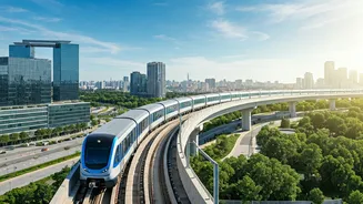
The 28.4-kilometer corridor under examination is a pivotal transportation artery within the vibrant city of Bengaluru. This stretch serves as a critical
link, facilitating connectivity between JP Nagar and Hebbal, and significantly impacts daily commutes and overall accessibility. The corridor is designed to ease traffic flow and enhance travel efficiency for residents and visitors alike. Its strategic placement directly affects multiple key areas within the city, improving mobility and reducing congestion in densely populated regions. The route provides crucial connectivity across diverse neighborhoods and business centers, making it a cornerstone for efficient urban transit. Travelers benefit from an improved experience due to better route options and reduced travel times. This comprehensive overview offers insights into the importance and practical implications of this vital transportation route.
Route Highlights
The corridor between JP Nagar and Hebbal is characterized by various landmarks and significant transit points. The journey involves traversing through busy commercial areas, residential districts, and key infrastructure sites. Major junctions and flyovers are integrated along this route, specifically designed to regulate traffic and ensure smooth transit during peak hours. Various public transport options are available, including buses and metro lines, that run parallel or intersect the corridor. These elements collectively contribute to the area's transportation network, making it a hub of activity. The corridor presents a blend of urban landscapes, from bustling marketplaces to quieter residential neighborhoods. This variety gives a unique perspective on Bengaluru's diverse urban character, allowing travelers to experience the city in all its forms. This corridor serves as a microcosm of the city's growth and infrastructure development.
Travel Considerations
Navigating the 28.4-kilometer corridor requires considering a few key aspects to ensure a seamless journey. The most effective route planning strategies should incorporate real-time traffic updates. This includes monitoring for delays or construction, which allows for proactive adjustments. Peak travel times often present challenges, requiring commuters to allow extra time for their journeys. Public transport options, such as the metro, offer reliable alternatives to driving during rush hours, improving travel times. Keeping in mind the availability of amenities along the route, such as service stations, food outlets, and rest stops, can add comfort to your travel experience. Planning your travel considering these factors can greatly improve your overall travel time and efficiency, ensuring a better experience along the Bengaluru corridor.
Future Developments
Future plans for the JP Nagar to Hebbal corridor aim to further improve transportation and infrastructure. Proposed expansions focus on enhancing connectivity and reducing congestion. These developments involve upgrades to existing roads and the introduction of new transit options, which could include rapid transit or bus rapid transit systems. Smart city initiatives are also anticipated, using technology to optimize traffic flow and improve public services. Such improvements include intelligent traffic management systems and advanced passenger information. These developments promise to enhance the route's efficiency and convenience, with the aim of promoting sustainable urban growth and improving the overall quality of life for all users. The advancements highlight Bengaluru's commitment to modernizing its infrastructure and providing effective solutions for its growing population.


![[WATCH] 'Real Madrid, Ramadan and rest' - Mohammed Siraj how last-minute World Cup call-up changed February plan](https://g-mob.glance-cdn.com/public/fc/image/ByYT_LEmlrD0.webp)


