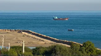


The GPS Problem
On the surface, we take GPS for granted, guiding us everywhere from our commutes to remote hikes. However, this indispensable technology falters dramatically
when submerged. Satellite signals, primarily radio waves operating at high frequencies like L-bands, are swiftly attenuated by water. The conductive nature of saltwater exacerbates this issue, causing signals to dissipate almost immediately. This means that even at shallow depths, submarines are completely cut off from the satellite constellations that power our everyday navigation. Systems like GLONASS, Galileo, and even China's BeiDou face the same fundamental obstacle. While extremely low-frequency (ELF) radio waves can penetrate water to some extent, their transmission speeds are painstakingly slow, rendering them impractical for real-time navigation during crucial underwater missions.
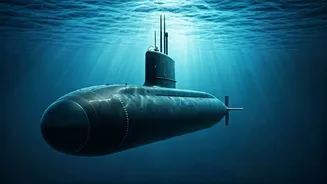
Inertial Navigation Systems
The cornerstone of underwater navigation is the Inertial Navigation System (INS). This sophisticated technology allows submarines to chart their course and track their position without any external references, a crucial capability for vessels that can remain submerged for extended periods and operate in near-total isolation. An INS begins with a known starting point. It then meticulously monitors any changes in motion using highly sensitive gyroscopes and accelerometers. These instruments detect the submarine's directional heading, velocity, and any displacement. By continuously integrating these movement data points over time, the INS estimates the vessel's current location. This self-contained system is vital for maintaining safe routes and operational integrity when traditional communication and navigation methods are unavailable due to the ocean's interference.
Error Correction Techniques
While INS is powerful, its accuracy can be affected by accumulating small calculation errors, leading to a phenomenon known as 'drift,' where the estimated position deviates from the actual location. To counteract this, submarines employ several supplementary techniques. Manual dead reckoning is a time-honored backup, where seasoned sailors estimate the submarine's position by factoring in its known heading and speed. More advanced methods involve comparing the underwater environment with pre-existing navigational data. Bathymetric charts, which provide detailed topographical maps of the seafloor, are invaluable for this comparison. Furthermore, terrain-relative navigation systems actively scan the seabed, comparing the detected topography with known maps to refine the estimated position and correct for drift, ensuring greater accuracy during long voyages.
Sonar and Acoustic Aids
In specific operational contexts, submarines can also leverage sonar technology for navigation, though this is done with considerable caution. Active sonar systems emit sound pulses and interpret the returning echoes to build a picture of the surrounding environment. This can aid in identifying underwater features and confirming position. However, using active sonar comes with a significant risk: it can inadvertently broadcast the submarine's presence to adversaries within range. Consequently, more discreet acoustic methods might be preferred. The precise application of sonar depends heavily on the mission's requirements and the need for stealth versus detailed environmental mapping, highlighting the complex balance navigators must strike underwater.