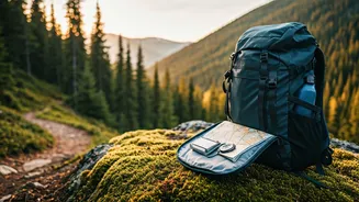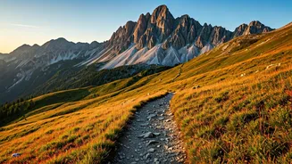


Watchman Trail: Zion's Gem
When the allure of Angels Landing calls but permits are elusive, the Watchman Trail in Zion National Park offers a superb, accessible alternative. This
3.3-mile out-and-back path, with a modest 646 feet of elevation gain, provides a more relaxed yet visually rewarding experience. You'll meander alongside the vibrant Virgin River, winding through a ravine to a mesa summit. From this vantage point, sweeping panoramas unfold, showcasing the expansive river valley, punctuated by resilient desert flora and iconic Zion formations like the Watchman Spire and the Towers of the Virgin. The trail is open year-round and conveniently located near the Zion Canyon Visitor’s Center, making it a practical choice. While it can attract crowds on busy weekends, the foot traffic is significantly less than Angels Landing. Sturdy, grippy footwear is recommended for the sandy and occasionally uneven terrain, and layering clothing is advisable for fluctuating desert temperatures. Adequate water and sun protection are essential due to the exposed nature of the trail, even on this shorter route. Starting early can help avoid the peak heat of the day and offers the benefit of the soft, warm light of dawn illuminating the landscape.
Clouds Rest: Yosemite's Majesty
For those who couldn't secure a permit for Yosemite's legendary Half Dome, Clouds Rest presents a equally breathtaking, albeit strenuous, alternative. This 12.5-mile round-trip hike begins at the Sunrise Lakes Trailhead and involves a substantial 3,200-foot elevation gain, particularly concentrated in the initial steep switchbacks. The reward for this effort is an unparalleled 360-degree vista from one of Yosemite Valley's highest accessible points. The summit offers spectacular views encompassing landmarks such as Cathedral Rocks, El Capitan, and the dazzling Tenaya Lake. The journey itself is a diverse experience, transitioning from dappled forests to challenging ascents, culminating in a thrilling scramble along a narrow, rocky ridge known as The Spine. From this elevated perch, you can even glimpse the distant trekkers on Half Dome's cables, offering a unique perspective from approximately 1,000 feet above. The prime season for this high-alpine trek is from late June to early October, avoiding snow and road closures. September is particularly favorable with milder weather and fewer insects. Be prepared for a long day, as the terrain can be demanding and daylight hours can be limited, especially in the shoulder seasons; a headlamp is a wise addition. Sun protection, sturdy footwear, and a hat are crucial as much of the trail is exposed and rocky. Afternoon thunderstorms are a common occurrence at this elevation, so having a flexible plan is important. Carrying at least two liters of water or a reliable water filter is recommended due to the exertion and elevation.
Tahoe Rim Trail: Sierra Splendor
If securing a permit for the John Muir Trail proves difficult, the Tahoe Rim Trail (TRT) offers a magnificent 167-mile thru-hike experience with comparable Sierra Nevada grandeur. This extensive trail forms a loop around the stunning Lake Tahoe, traversing diverse terrain including crystal-clear alpine lakes, expansive glacial valleys, rugged peaks, and serene meadows dotted with seasonal wildflowers. The total elevation gain approaches 30,000 feet, providing a continuous challenge and awe-inspiring scenery. Wildlife sightings can include black bears, golden eagles, and Steller's jays, amidst dense forests of red fir and lodgepole pine. The trail's proximity to mountain towns allows for convenient resupply points, and refreshing dips in Lake Tahoe are readily available. A significant highlight of the TRT is its passage through the Desolation Wilderness, a landscape characterized by large erratic boulders, dramatic open ridges, and rolling granite formations, all offering spectacular views of Lake Tahoe. While the TRT itself doesn't require a permit for thru-hiking, overnight stays within the Desolation Wilderness do necessitate advance permits. However, a specific thru-trekker overnight use quota zone for the TRT became available starting March 20, 2026. It is important to camp within 300 feet of the TRT corridor with this permit and avoid Lake Aloha. Dispersed camping is generally permitted elsewhere along the route. A California Campfire Permit is also required for using a stove on any part of the trail. The optimal window for tackling the TRT is typically from July to September, though snow can persist on higher elevations and north-facing slopes well into August. Be prepared for potentially buggy, dusty, and hot conditions during summer, necessitating ample sunscreen, a head net, and a robust water system. Due to bear habituation in the Lake Tahoe area, a secure, bear-proof food storage system is imperative.
Beaten Path & Beartooth Highway
For those deterred by the crowds or logistical challenges of Glacier National Park's Going-to-the-Sun Road, the Beaten Path hike combined with the Beartooth Highway in Montana presents an equally spectacular, yet less congested, adventure. This 26.3-mile point-to-point trek, with an elevation gain of 3,300 feet, winds through the Beartooth-Abroska Wilderness, recognized as the largest contiguous alpine wilderness area above 10,000 feet outside of Alaska. The trail navigates past tumbling waterfalls, meandering creeks, boulder-strewn meadows, and numerous cerulean alpine lakes. Keep an eye out for wildlife such as grizzly bears and moose, and enjoy the vibrant seasonal wildflower displays. The experience is complemented by the adjacent Beartooth Highway, a 68-mile scenic drive connecting Red Lodge and Yellowstone, offering unparalleled vistas of stark, snow-dusted granite peaks and pristine forests that evoke a profound sense of scale and wilderness. The Beaten Path hike is best experienced from mid-July through September. Given the significant snowfall in the Beartooth Range, aiming for later in the season is advisable. The trail is best hiked from east to west, starting at the East Rosebud Trailhead to reduce elevation gain. It's a point-to-point hike with no shuttle service; hikers typically arrange for a car drop at either end, or rely on shuttle services. Warm clothing is essential for potential storms or unpredictable weather. The numerous glimmering lakes offer opportunities for a refreshing plunge, so a microfiber towel is a good item to pack. For anglers, the area provides ample opportunities for trout fishing. Crucially, bear spray is a must-have and can be rented or purchased in Red Lodge, Cooke City, or near Yellowstone. The remoteness of the trailheads requires careful planning for transportation, with Forest Service roads potentially being bumpy.
Washakie Pass Loop: Winds' Embrace
If the Teton Crest Trail permit deadline has passed, the Washakie Pass Loop in Wyoming's Wind River Range, often affectionately called 'The Winds,' offers a profound and equally challenging backcountry experience. This 36.5-mile loop, with a demanding 6,650 feet of elevation gain, traverses landscapes sculpted by millennia of tectonic and glacial activity, including the iconic horseshoe-shaped Cirque of the Towers, a dramatic collection of over a dozen peaks exceeding 12,000 feet. As you ascend to the tundra-draped Lizard Head Plateau, expect expansive, wrap-around views, with frequent opportunities to capture the Cirque framed by serene alpine lakes. The route also meanders through deep meadows bursting with vibrant prairie bluebells, alongside gushing streams, and into resplendent valleys nestled between imposing slate-grey walls. This classic adventure truly immerses you in the rugged beauty of the Rockies. The prime season for this trek is from July to September, though snow can linger into late summer. Be prepared for fast-moving afternoon thunderstorms, particularly in July and August, and consider bringing insect repellent for mosquitoes and biting flies before mid-August. September offers cooler evenings but rewards with illuminated, russet-colored meadows that create a stunning visual spectacle. Most hikers opt for a clockwise direction for navigational ease, to manage the elevation gain more effectively, and to save the dramatic reveal of the Cirque of the Towers for last. An optional 12-mile out-and-back spur to Texas Pass is available for those seeking an additional climb. Sturdy, ankle-supporting boots are essential for navigating the leg-testing, scree-covered grades. Bear spray is also a necessary safety precaution. Access to the trailhead involves navigating approximately 27 miles of bumpy dirt roads, which, while generally manageable with a two-wheel-drive vehicle, is more easily handled with a high-clearance vehicle. The Big Sandy Trailhead can experience significant crowds and limited parking, so arriving early is strongly advised. Pinedale, a town about 1.5 hours away, offers convenient lodging for an early start.
Alice Lake-Toxaway Loop: Sawtooth Serenity
For those who couldn't secure a permit for the popular Enchantments Traverse, the Alice Lake-Toxaway Loop in Idaho's Sawtooth Wilderness offers a comparable, yet often less crowded, backpacking experience. This 18.8-mile loop is renowned for its stunning alpine scenery, leading hikers through tranquil forests and over grand passes with an elevation gain of 3,130 feet. The Sawtooth peaks, often described as washed with soft lavender, surround a landscape dotted with countless shimmering turquoise lakes. Similar to the Enchantments, this trail features exceptional water features, including fish-stocked creeks, burbling streams, and narrow waterfalls cascading into verdant valleys. The numerous flat, sun-baked granite slabs near Toxaway Lake provide ideal spots for rest and contemplation. Twin Lakes, nestled within their alpine embrace and flanked by majestic granite slopes, are another highlight. Waking up beside Alice Lake offers a particularly magical experience, with sunrise casting El Capitan in a warm, honey-colored light, perfectly reflected in the still waters below. The relatively low visitor numbers in the Sawtooths contribute to a sense of solitude and connection with nature. The Tin Cup-Petit Lake trailhead, just three hours from Boise, typically offers ample parking and dispersed camping options for overnight stays prior to the hike. While the loop is well-maintained and can be hiked in either direction, a counterclockwise approach is often recommended to minimize long downhill switchbacks and maximize the scenic views. An optional three-mile, 1,000-foot gain spur to Edith Lake provides an opportunity for further tranquility. Daytime temperatures are generally pleasant during the peak season, but nights can still dip below freezing, so warm gear is essential. Bear canisters are mandatory, as are sturdy hiking boots with good traction and waterproof footwear for creek crossings. Popular campsites, particularly at Alice Lake, can fill up quickly; an alternative is to turn right at a trail junction to find less-used spots. Leashed dogs are permitted on this trail.
Coyote Gulch Loop: Canyon Magic
When the Grand Canyon Rim-to-Rim hike is out of reach, the Coyote Gulch Loop in Grand Staircase-Escalante National Monument provides an equally thrilling, albeit shorter, adventure. This 10.6-mile loop trail, with a 1,643-foot elevation gain, leads you through spectacular slot canyons and past striking geological formations, including towering maroon and Navajo sandstone buttes. The route offers opportunities to discover ancient petroglyphs, explore deep rock alcoves, and marvel at year-round waterfalls. Lush hanging gardens and streams lined with vibrant cottonwood and willow trees create a striking contrast against the orange and black-streaked sandstone. Natural arches and bridges add a mystical, cathedral-like quality to the landscape. While not as extensive as the Grand Canyon, this hike delivers considerable adrenaline through route-finding challenges, scrambles, and boulder-hopping. Resting near the impressive Jacob Hamblin Arch after a day of exploration is a memorable experience, enhanced by the stunning celestial light that shines through the arch at night. The best times to tackle this hike are from March to June and September to October, to avoid extreme desert heat. It's crucial to monitor weather conditions closely, as rainstorms can lead to impassable mud and dangerous flash floods. A cord will be needed to lower backpacks through the 100-foot-long Crack-in-the-Wall, which requires careful shimmying. Expect sections of free climbing, slickrock, and slow going through sand. Much of the hike involves wading through ankle-deep water, making waterproof shoes highly recommended. Trails are not consistently signed, so a GPS device or map is essential. A WAG Bag for human waste and a no-quota safety permit, obtainable at the Visitor's Center, are also required. The trailhead is accessed via unpaved Fortymile Ridge Road, which includes two miles of dense sand that is best navigated with a four-wheel-drive vehicle. Camping at the trailhead and starting early is advisable to avoid the intense desert heat and to witness the ethereal light playing on the canyon walls.
Buckskin Gulch: Slot Canyon Depths
For those unable to secure permits for The Wave, the Buckskin Overlook via Wire Pass Trail offers an extraordinary slot canyon adventure. Buckskin Gulch itself is one of the world's longest continuous slot canyons, and the Wire Pass Trail provides access over a 5.7-mile out-and-back route that is relatively flat. Prepare to navigate obstacles such as wedged boulders, loose sand, and uneven terrain between towering, undulating sandstone walls that can reach 200 feet high. The immense canyon walls often block direct sunlight, creating an intimate and awe-inspiring atmosphere. The sinuous, layered rock formations reveal a mesmerizing palette of warm burgundy, grey, and violet hues, smoothed over centuries by the force of water. This journey is characterized by its demands for physical agility, requiring participants to scramble, use ladders, and wade through muddy, cold standing water that can sometimes reach chest-deep. The canyon is rarely wider than 10 feet, emphasizing a sense of compression and immersion in nature's grandeur. This adventure requires careful planning regarding permits and potential hazards. A permit is required for this hike, costing $6 per person and per dog, obtainable through Recreation.gov. Unlike The Wave, there is no day-use quota for Buckskin Gulch. The ideal hiking seasons are March-June and September-October, avoiding the peak summer heat and the monsoon season. Flash flooding remains a significant risk and can occur at any time, particularly between June and August. Thoroughly checking weather forecasts is crucial, as rain within a 40-mile radius can trigger dangerous conditions. Waterproof shoes and quick-drying clothing are highly recommended due to frequent water crossings. It's essential to carry more water than you think you'll need, as there is no water available at the trailhead or within the canyon for filtering. A WAG Bag is mandatory for all human waste. Remote access and the presence of venomous creatures like rattlesnakes and tarantulas necessitate caution and preparedness. The Wire Pass Trailhead is reached via unpaved House Rock Valley Road, which can be a rough ride, making a four-wheel-drive vehicle advisable.
Santa Cruz Island: Island Escape
If the Kalalau Trail feels too distant or inaccessible, Santa Cruz Island in Channel Islands National Park offers a remarkable island hiking and overnight experience without the extensive travel. Often dubbed the 'Galapagos of North America,' these eight Pacific islands off the coast of Ventura, California, boast a unique ecosystem. Expect to see olive-hued scrub and sagebrush cascading towards the ocean, fields dotted with cheerful yellow giant coreopsis, and stunning sunsets painting the mountaintops in rosy hues. This 12.8-mile overnight trek involves a 2,677-foot elevation gain along an exposed, moderately maintained, and brushy trail, so packing long pants is advisable. The hike culminates in a scramble along Montañon Ridge, offering expansive, dream-like views. You'll also traverse canyons and oak groves, walk along a historic ranch road, and can take a brief detour to the picturesque Potato Harbor cove. During the day, look for dolphins offshore, endemic island foxes, and vibrant island morning glory flowers. At night, the campsite offers views of the wavy shoreline and ochre limestone bluffs, accompanied by the sounds of sea lions and waves. Key planning elements for Santa Cruz include water, campsites, and transportation. Ferries typically depart from the mainland, often arriving at Scorpion Anchorage. If starting from Prisoners Harbor, arranging a split drop-off/pick-up with the ferry service is necessary. Booking ferries and campsites well in advance is crucial, as is allowing buffer time for travel and potential weather delays impacting ferry schedules. There are two designated campgrounds: Del Norte (three miles in, with four primitive sites) and Lower Scorpion Canyon (at the terminus, with 25 sites). Carrying all necessary water is imperative, as potable water is scarce, with a tap available only at Scorpion Anchorage. Camping fees apply, and dispersed camping is not permitted. The island is particularly stunning in winter or spring when it's lush and green, becoming drier in the summer. Be prepared for dense fog and heavy dew, which can make grassy paths damp. The trail can be eroded in places, requiring careful descents. A hat, sunscreen, and polarized sunglasses are recommended for the limited shade.
Oregon Coast Trail: Coastal Wonders
For those who missed out on the Lost Coast Trail, a 31.5-mile section of the Oregon Coast Trail provides an equally captivating, though different, coastal adventure. This segment meanders between dense, mossy rainforests and the vast Pacific shoreline, offering opportunities to observe playful sea lions, distant whales, and abundant birdlife, often in solitude. The trail demands a keen awareness of tidal patterns; walking on packed wet sand during low tide is crucial for easier passage, and three rivers that surge at high tide must be crossed. The invigorating scent of sea spray and the breathtaking beauty of purple-pink twilight skies make the planning worthwhile. You'll encounter impressive hemlocks and Sitka spruce trees clinging to coastal bluffs that rise up to 100 feet, witness waves tumbling polished driftwood, and experience the pervasive, spongy fog that often blankets the sea. Binoculars are recommended for wildlife viewing. As you approach the dramatic Cape Blanco headland, keep an eye out for the historic lighthouse. Most hikers opt for a southbound direction to have the prevailing coastal winds at their back. Transportation at the end of the trail typically involves hitchhiking back to a vehicle along Highway 101 or arranging for a car drop. Public bus service is also available on weekdays, though with reduced hours. The optimal hiking period is from June through September, offering a lower chance of heavy rainfall, which helps keep river crossings manageable. Waterproof footwear, a rain jacket, and warm layers are essential for strong gusts and potential coastal showers. Since much of this trek is on beaches, a tide chart and knowledge of storm swells are vital before setting up camp. Advance campsite reservations are necessary, as designated sites can be spread apart. Additionally, hikers must avoid wildlife management areas, specifically dunes where Snowy Plovers nest from March 15 to September 15. Campfires are generally permitted with specific restrictions, and dogs are prohibited on the trail during the bird nesting season. The trail's beauty is enhanced by its blend of lush forests and dramatic coastal scenery.