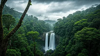


Mawsynram's Rainfall Reign
Frequently recognized as the pinnacle of Earth's precipitation, Mawsynram, nestled in India's Meghalaya region, experiences an average annual rainfall
exceeding 11,000 mm. Its strategic placement within the Khasi Hills, directly in the path of the Bay of Bengal monsoon, makes it an unparalleled rain-gathering locale. The environment is a testament to this constant hydration, characterized by verdant, undulating hills, numerous cascading waterfalls, and the remarkable living root bridges meticulously crafted by the indigenous Khasi people. This area isn't just defined by rain; it's sculpted by it, creating a breathtaking natural tableau. The Khasi Hills act as a natural funnel, capturing the moisture-laden air masses from the Indian Ocean. As these masses ascend the hills, they cool and condense, leading to the persistent and heavy rainfall that Mawsynram endures. The topography plays a crucial role, with the surrounding valleys and peaks contributing to the microclimate that sustains such extreme levels of precipitation. The local communities have adapted ingeniously, developing unique architectural and agricultural practices that leverage the abundant water resources, ensuring their survival and prosperity in this extraordinarily wet environment. The lush vegetation is a direct consequence of this continuous moisture, supporting a rich biodiversity that is characteristic of tropical rainforests.
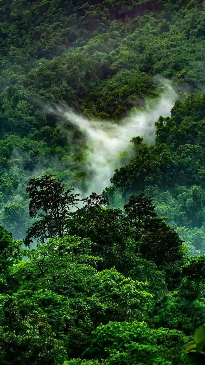
Cherrapunji's Grandeur
Just a stone's throw from Mawsynram lies Cherrapunji, a place that once held the title of Earth's wettest. While it may have yielded its top spot, Cherrapunji continues to astound with its exceptionally high rainfall figures. This region is renowned for its dramatic cliff faces, extensive cave systems, and magnificent waterfalls, such as the awe-inspiring Nohkalikai Falls. Cherrapunji serves as a powerful illustration of how relentless rain can artistically shape and define natural beauty, creating a landscape of unparalleled grandeur and dramatic geological formations. The geological features of Cherrapunji, including its steep escarpments and porous limestone formations, contribute significantly to its high precipitation. The interaction between the monsoon winds and the mountainous terrain creates a scenario where moist air is forced upwards, leading to condensation and heavy rainfall. The sheer volume of water has carved out deep gorges and stunning waterfalls, with Nohkalikai Falls being a prime example, plummeting hundreds of meters from the plateau edge. The caves, many of which are still being explored, are formed by the dissolution of limestone by the abundant rainwater over millennia. The constant flow of water sustains a dense, verdant forest cover that cloaks the hillsides, adding to the region's mystical and breathtaking appeal.
Tutunendo's Tropical Deluge
Tutunendo, situated within Colombia's Choco region, stands out as one of South America's most rain-drenched inhabited locales. It consistently records rainfall surpassing 11,000 mm on an annual basis, with the rain often being a daily occurrence. This perpetual moisture fosters an incredibly thriving environment for the surrounding tropical rainforests, making the area a hotspot of biodiversity and a remarkable example of life flourishing under extreme conditions. The sheer abundance of water is the lifeblood of this vibrant ecosystem. The location of Tutunendo, close to the Pacific coast and within the Amazonian biome, exposes it to consistent influxes of moisture-rich air. The equatorial climate combined with the geographical positioning ensures that the region experiences high humidity and frequent convective rainfall throughout the year. This leads to an exceptionally lush and dense rainforest ecosystem, supporting an extraordinary array of plant and animal species. Many species found here are endemic, having adapted specifically to the high rainfall and humidity. The local indigenous communities have developed unique ways of life, utilizing the abundant resources provided by the forest and the rivers, which are swollen by the incessant rains.
Debundscha's Coastal Rain
Located at the foot of the majestic Mount Cameroon, Debundscha is a region that experiences significant rainfall, often reaching approximately 10,000 mm annually. This phenomenon is primarily due to the prevailing moist ocean winds that are compelled to ascend the slopes of Mount Cameroon, leading to substantial precipitation. Despite the intensity of its weather patterns, Debundscha captivates with its striking coastal vistas and the dramatic volcanic landscape that forms its backdrop, showcasing nature's resilience and beauty. The orographic effect plays a crucial role in Debundscha's high rainfall. As warm, humid air from the Atlantic Ocean moves inland, it encounters the formidable barrier of Mount Cameroon. The air is forced to rise rapidly, causing it to cool and condense, resulting in heavy rainfall on the windward side of the mountain, where Debundscha is situated. The volcanic soil, enriched by past eruptions and constant moisture, supports a unique flora adapted to these conditions. The coastal proximity also influences the weather, contributing to the high humidity and frequent cloud cover, which further enhances the rainfall. The juxtaposition of the lush, rain-soaked lowlands with the imposing volcanic peak creates a visually stunning and ecologically diverse environment.
Cropp River's Record Deluge
The Cropp River area in New Zealand has etched its name in the record books, having recorded the highest rainfall in a single year, an astonishing figure exceeding 18,000 mm. This extreme precipitation is a direct consequence of the region's geography in the Southern Alps. The terrain forces moisture-laden winds to ascend rapidly, leading to a rapid cooling and condensation process that triggers intense and frequent rainfall, making it one of the most exceptionally wet spots globally. The mountainous topography of the Southern Alps is instrumental in creating the extreme rainfall patterns observed at the Cropp River. When moist air masses from the Tasman Sea are channeled through the mountain passes and over the peaks, they are forced to rise dramatically. This rapid adiabatic cooling causes the water vapor to condense, leading to prodigious amounts of rainfall. The specific location of the Cropp River, in a valley that acts as a natural funnel, exacerbates this effect. The area is characterized by steep, heavily forested slopes, with numerous glaciers and snowfields at higher elevations that contribute to the water cycle. This constant saturation sustains a unique alpine and temperate rainforest ecosystem, with exceptionally high vegetation growth and numerous fast-flowing rivers and streams.