





A Multi-Agency Warning System
Kerala's flood warning apparatus is a complex network of central and state agencies. The India Meteorological Department (IMD) provides rainfall forecasts, issuing colour-coded alerts like yellow, orange, and red to indicate severity. The Central Water
Commission monitors river levels, while the Kerala State Disaster Management Authority (KSDMA) is tasked with consolidating this information and disseminating it to the public and district administrations. In the years since the devastating 2018 floods, the state has invested in strengthening this framework, creating a State Disaster Response Force and developing more detailed risk mapping. On paper, the system is more robust than ever. However, recurring deluges show that the challenge isn't just about having a system, but making it work effectively under pressure.
The Critical Dilemma of Timing
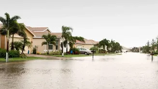
The timing of a flood warning is a delicate balancing act. Issue it too early, and it risks being dismissed, leading to a 'cry wolf' effect where future alerts are ignored. Issue it too late, and it offers no practical window for evacuation or protective measures. During recent floods, officials and residents have lamented that crucial alerts about intense rainfall came too late, leaving little time to save property or move to safer locations. An early warning could have saved significant stock for shops in submerged towns like Ranni and Aranmula. The increasing frequency of highly localised, intense downpours, sometimes called mini cloudbursts, further complicates forecasting. These sudden events shrink the window for effective prediction, making timely, actionable warnings more challenging than ever.
Beyond Rainfall: The Need for Granular Detail
A generic warning for "heavy rainfall" in a district is often insufficient. For a warning to be truly effective, it must be specific and impact-based. Residents need to know not just that it will rain, but what the consequences will be for their specific locality. Will their village be inundated? By how much? Which roads will become impassable? After 2018, efforts were made to create more detailed flood inundation maps and local disaster management plans. However, experts point out that the lack of accurate, shared ground-level data continues to hamper response. To be truly useful, warnings must evolve from broad meteorological forecasts into hyper-localised impact assessments that tell people exactly what to expect, enabling them to make informed decisions.
Response: The Last, Most Crucial Mile
Even a perfectly timed and detailed warning is useless if it doesn't trigger an effective response. This "last mile" connectivity is often the weakest link in the chain. It involves not just alerting the public, but ensuring local bodies, panchayats, and community groups know precisely how to act. This includes having clear evacuation protocols, pre-identified shelter locations, and robust communication channels that function even when infrastructure fails. The 2018 floods showcased the incredible power of community response, with fishermen rescuing thousands when official systems were overwhelmed. While institutional frameworks have improved since, ensuring that preparedness is embedded at the community level remains a constant challenge. This requires continuous training, drills, and empowering local self-governments to lead on-the-ground efforts.
Looking Ahead: AI and Integrated Planning
Recognising these challenges, the Kerala government is now looking towards technology and integrated planning. There are plans to roll out an advanced AI-powered disaster management system to predict sudden climate shifts and provide more accurate early warnings. This initiative involves expanding the network of rain gauges and partnering with research institutions. Furthermore, there is a renewed focus on addressing the root causes of flooding, such as clearing silted-up rivers to improve their water-carrying capacity and regulating construction on fragile slopes. The ultimate goal is to move from a reactive disaster response to a proactive, resilience-focused model where technology, policy, and community action work in sync to mitigate the inevitable force of the monsoon.