





A Surprising Gain in Height
In a surprising reversal of recent trends, the mighty Mont Blanc is 'taller' than it was three years ago. According to the latest measurements announced on October 14, 2026, the peak now stands at 4,807.47 metres. This marks an increase of nearly 1.9
metres from its last official measurement of 4,805.59 metres in 2023, which was the lowest recorded since modern surveys began. For over two decades, teams of expert surveyors from France's Haute-Savoie region have made the arduous trek to the summit every few years. Their mission is to precisely chart the height of this iconic landmark, providing crucial data for scientists.
The Science of a Shifting Summit
It is not the mountain itself that is growing, but the thick cap of snow and ice that blankets its rocky peak. The actual rock summit of Mont Blanc is stable at around 4,792 metres. The height of the snow and ice on top, however, is in constant flux, changing with the seasons and weather patterns. Wind, precipitation, and temperature all play a role in how much snow accumulates or is scoured away from the summit. Surveyors note that the height has fluctuated over the years, reaching a high of 4,810.90 metres in 2007. This dynamic nature is why a single measurement does not tell the whole story, but rather contributes to a long-term understanding of the mountain's behaviour.
An Expedition with High-Tech Tools
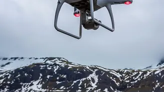
Getting this new measurement was a monumental effort. A team of over 30 people, including surveyors, mountain guides, and scientists, participated in the expedition in mid-September 2026, carrying nearly 30 kilograms of scientific equipment to the top. For the first time, their toolkit included a sophisticated drone alongside traditional satellite positioning systems. The drone flew over the summit, capturing more than 1,300 georeferenced images to create a highly detailed 3D model of the ice cap. This provides a far more comprehensive picture of the summit's volume and shape than ever before.
Peering Beneath the Ice
Perhaps the most fascinating tool deployed was ground-penetrating radar (GPR). This technology works by sending radio waves into the ground—or in this case, the ice. When these waves hit a boundary between different materials, such as the divide between the ice cap and the rock beneath, they reflect back to a receiver. By measuring the time it takes for the signal to return, scientists can create a precise map of what lies beneath the surface. This allowed the team to distinguish the depth of the permanent ice and snow from the solid rock, giving them a complete picture of the summit’s composition.
A Barometer for a Changing Planet
While Jean des Garets, the chief surveyor, cautioned that one measurement is not conclusive evidence of climate change, the long-term data set is invaluable. By tracking these fluctuations over decades, scientists can better understand the impact of climatic shifts on sensitive high-alpine environments. The data helps glaciologists model how the ice cap is behaving and whether its overall mass is changing. In a world grappling with melting glaciers from the Alps to the Himalayas, every piece of data from these icy sentinels provides a vital clue about the health of our planet.