



The Challenge: Seeing Through the Smoke
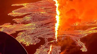
During and after a volcanic eruption, vast clouds of ash and gas, combined with normal weather clouds, create a thick blanket that makes it impossible for standard optical cameras to see the ground. This presents a major problem for emergency responders
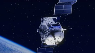
and scientists who need to know where lava is flowing, how the landscape is changing, and what areas are covered in ash. For people on the ground, getting close is often too dangerous. For pilots, flying through an ash cloud, which doesn't appear on normal weather radar, can lead to engine failure. This is where specialized satellite sensors become indispensable, offering capabilities that go far beyond what the human eye can see.
The All-Weather Eye: Synthetic Aperture Radar (SAR)
One of the most powerful tools for volcano monitoring is Synthetic Aperture Radar, or SAR. Unlike a regular camera that captures reflected light, a SAR instrument actively sends out its own radar pulses towards the Earth's surface and measures the signal that bounces back. Crucially, these radar waves can penetrate clouds, ash, and darkness, providing a clear view of the ground day or night, regardless of the weather. By comparing SAR images taken at different times, scientists can create incredibly detailed maps of change. This technique, called interferometry (InSAR), can detect ground deformation—subtle swelling or sinking of the volcano's surface—down to the centimetre. This can signal that magma is moving underground, potentially indicating an impending eruption. It also allows for rapid mapping of new lava flows and thick ash deposits by showing exactly how the physical texture of the ground has been altered.
Detecting the Heat: Infrared and Thermal Imaging
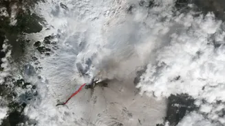
While radar maps physical changes, another set of satellite instruments specialises in detecting heat. Infrared sensors, like those on the Landsat and Copernicus Sentinel-2 missions, can identify the intense thermal energy emitted by molten lava. Using shortwave infrared (SWIR) wavelengths, these satellites can pinpoint the location of active lava flows, even when they are obscured by smoke or steam. In these false-colour images, hot lava flows often appear as bright orange or yellow streaks against the cooler landscape. This is vital for tracking the path of a lava flow in near real-time, helping authorities to forecast its direction and issue timely evacuation warnings. Systems like NASA's MODVOLC automatically scan satellite data to detect these thermal hotspots around the globe, providing alerts within hours of activity.
Assessing the Aftermath: Optical and Multispectral Imagery
Once the initial eruption calms and the ash plume dissipates, traditional optical satellites play a key role. Satellites like those in the Pléiades constellation provide high-resolution, colour images that are similar to what our eyes see. These detailed pictures are invaluable for assessing the full extent of the damage. They can be used to map the precise boundaries of lava fields, identify infrastructure that has been destroyed, and determine the thickness of ashfall on agricultural land and in communities. The main limitation is their reliance on clear, cloud-free skies. By combining information from SAR, infrared, and optical satellites, scientists and disaster management agencies get a comprehensive and layered understanding of an eruption's impact, from the initial underground rumblings to the long-term recovery of the landscape.