





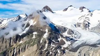
The Threat From Above
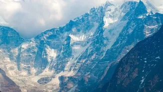
A hanging glacier is a body of ice that originates high on the wall of a mountain valley but stops abruptly, often at a cliff, instead of flowing down to the main valley floor. Think of it as a river of ice perched thousands of metres up. Unlike valley glaciers
that grind slowly forward, hanging glaciers are inherently unstable. Gravity constantly tugs at them, and as they grow heavier with snowfall or are weakened by melting, large sections can break off without warning. This process of shedding ice and snow, known as avalanching, is a natural part of their lifecycle, but it becomes a deadly threat when it happens on a massive scale above populated areas.
A Himalayan Wake-Up Call
The tragic events in Uttarakhand’s Chamoli district in February 2021 serve as a stark reminder of this danger. A massive portion of rock and a hanging glacier from Ronti Peak broke away, plummeting into the valley below. The impact generated a colossal flow of debris, mud, and water that tore through the Rishiganga and Dhauliganga river valleys. The surge destroyed two major hydropower projects and led to the loss of over 200 lives. Scientists later confirmed the disaster was not a glacial lake outburst flood (GLOF), but a direct result of this rock and ice avalanche, turning a remote geological event into a devastating human tragedy in minutes.
The Power of Watching
While we cannot stop a glacier from collapsing, we can watch for the warning signs. This is where monitoring becomes a life-saving tool. Modern Early Warning Systems (EWS) use a combination of technologies to detect the subtle changes that often precede a disaster. Satellite imagery can reveal developing cracks and changes in a glacier's shape over time. Ground-based instruments, such as seismic sensors, can pick up the vibrations from shifting ice and rock, while automatic weather stations track temperature and precipitation, which influence glacier stability. The goal is to piece together this data to identify a growing threat before it becomes critical.
From Data to Evacuation
An effective EWS is more than just sensors; it is an integrated chain of communication designed to turn data into action. Once monitoring systems detect a high-risk situation—like accelerating ice movement or the sound of rockfall—an automated alert is triggered. This warning must then be rapidly disseminated to authorities and, most importantly, to the communities living downstream. Sirens, SMS alerts, and radio broadcasts can deliver the crucial message. Even a few minutes of advance notice can be enough time for people to evacuate to higher ground, transforming a potentially fatal disaster into a near-miss. These systems provide precious time, which is the most valuable resource in an emergency.
The Obstacles on the World's Rooftop
Implementing comprehensive monitoring in the Himalayas is a monumental challenge. The terrain is among the most rugged and inaccessible on Earth. Installing and maintaining sensitive equipment at high altitudes, where extreme weather is the norm, is logistically difficult and expensive. Many of these hazardous glaciers are in remote areas with no power or conventional communication networks, requiring solutions like satellite data transmission. Furthermore, with tens of thousands of glaciers in the Himalayas, it is impossible to monitor every single one. Scientists must prioritize the most potentially dangerous ones, a difficult task in a rapidly changing environment.