







An Orbit Unlike Any Other
Most Earth observation satellites, like those in the Cartosat series, operate in Low Earth Orbit (LEO), circling the globe a few hundred kilometres up. They capture incredibly detailed images but can only view a specific location when they pass over it,
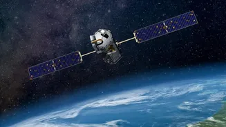
which can take days. EOS-05, however, is different. It operates from a geosynchronous orbit, positioned approximately 36,000 kilometres above the Earth's surface. At this altitude, its orbital speed matches the planet's rotation, allowing it to remain fixed over the Indian subcontinent. This unique positioning transforms it from a passing photographer into a constant, unwavering observer.
A Mission of Constant Vigilance
The primary advantage of this geostationary perch is the ability to provide near real-time imaging. EOS-05 can capture an image of the entire Indian landmass every 30 minutes, and for a specific area of interest, it can do so every five minutes. This capability is a game-changer for monitoring rapidly evolving events. Think of a cyclone making landfall, a forest fire spreading through dry terrain, or the sudden onset of flash floods. While LEO satellites provide snapshots, EOS-05 delivers a continuous stream of information, allowing authorities to track disasters as they unfold and make critical, timely decisions to save lives and property.
More Than Just Weather Watching
While disaster management is a key application, the satellite's purpose extends far beyond that. Its multispectral and hyperspectral sensors can monitor agricultural health, track changes in forest cover, assess soil moisture, and manage water resources. This data is invaluable for a nation where agriculture is a cornerstone of the economy and environmental sustainability is a growing concern. The satellite's sensors analyze how different surfaces reflect light, helping distinguish between vegetation, water, and other land covers, providing a rich dataset for environmental and agricultural planning.
The Strategic Edge
ISRO has described EOS-05 as a "strategic" asset, and for good reason. Its ability to maintain a persistent watch over the Indian subcontinent and its surrounding maritime and land borders provides a significant security advantage. While officials have noted it is not a "spy satellite" in the traditional sense, its wide-area surveillance capabilities are undeniable. It can monitor regions of interest, offering a layer of observation that complements other defence and surveillance systems. This constant oversight is a powerful tool for maintaining national security and monitoring territorial integrity.
An Enduring National Asset
Launched in September 2026, the satellite, also known as GISAT-1A, represents a crucial capability for India. Even as newer and more advanced satellites are planned and launched, the specific role of EOS-05 remains vital. No LEO satellite can replicate its function of providing high-frequency, wide-area coverage of a single, vast geographical region. It fills a unique observational gap, acting as a foundational piece of India's space infrastructure. It is not just another piece of hardware in orbit; it is a dynamic tool that strengthens India's resilience, security, and scientific capabilities, proving that its importance has only grown since it first reached for the stars.