




Another Monsoon, Another Crisis
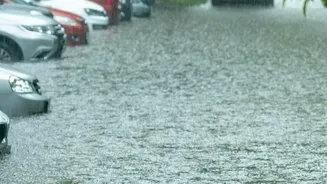
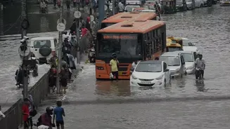
The first week of August 2026 saw Kerala confronting a familiar crisis as relentless monsoon rains triggered widespread flooding and landslides. Districts like Pathanamthitta, Kottayam, and Idukki were severely affected, with overflowing rivers submerging
homes and forcing the evacuation of over 18,000 people to relief camps. The death toll from this recent spell has climbed, with numerous people injured and hundreds of homes damaged or destroyed. Rescue teams, including the NDRF and local volunteers, have been working tirelessly. Yet, despite improved disaster response mechanisms since the catastrophic 2018 floods, a crucial problem persists: the warnings often come too late or are too broad to be truly effective.
The Limits of Large-Scale Forecasts
The India Meteorological Department (IMD) issues alerts, such as red or orange, for entire districts. While these are vital, they often lack the granularity needed for a state with such varied geography as Kerala. A red alert might warn of over 204 mm of rain in a district, but it cannot specify which village, panchayat, or hillside is at immediate risk of a flash flood or landslide. This year, there were instances where an orange alert for heavy rain was issued, but conditions deteriorated dramatically overnight, catching local administrations off guard. Scientists note that sudden, intense downpours from convective clouds are notoriously difficult to predict with traditional, large-area models. This gap between a district-wide warning and on-the-ground reality can be the difference between a timely evacuation and a tragedy.
What Are Hyperlocal Warnings?
Hyperlocal weather forecasting is the science of predicting weather for a very specific, small area—down to a neighbourhood or even a few square kilometres. Instead of a single forecast for an entire district, it provides real-time, high-resolution updates. This is achieved by combining data from a dense network of automated weather stations, ground-based sensors, Doppler radars, and satellite imagery. Advanced technologies like Artificial Intelligence (AI) and machine learning then process this vast amount of data to generate pinpoint predictions that can be updated every few minutes. This system can predict which specific community is in the path of a flash flood, allowing for targeted alerts and highly efficient deployment of emergency services.
A Game-Changer for Kerala’s Complex Terrain
For a state like Kerala, with its winding rivers, fragile Western Ghats slopes, and densely populated low-lying areas, hyperlocal warnings would be revolutionary. A sudden burst of rain in the mountains of Idukki can cause a river in Kottayam to swell dangerously within hours. Broad forecasts struggle with these microclimates. Hyperlocal systems could provide specific advisories, warning a village downstream of an impending surge from an upstream dam or a specific hillside community about landslide risk due to soil saturation. Recognising this, the Kerala government has announced plans to roll out an advanced AI-backed disaster management programme. Chief Minister V.D. Satheesan stated the aim is to create one of the country's most effective systems, with a pilot project planned for the hard-hit Pathanamthitta district.
The Path to Pinpoint Accuracy
Implementing a robust hyperlocal warning system is not without challenges. It requires significant investment in infrastructure, including a dense network of sensors and the computational power to process the data in real time. There are also hurdles in finding suitable sites for installing automated weather stations. Perhaps the biggest challenge is the 'last-mile connectivity'—ensuring that these highly specific, timely warnings reach every person at risk, especially in remote or poorly connected areas. This involves leveraging every possible communication channel, from smartphone apps and SMS alerts to traditional public address systems. Citizen-led initiatives in Kerala have already shown the power of community-level rainfall monitoring using WhatsApp groups to share data and alerts, demonstrating a viable path forward.