
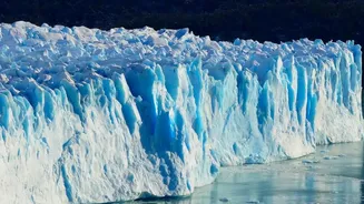
A Monumental Break
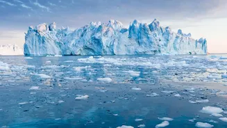
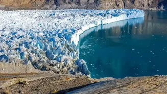
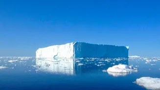
In early August, a 76-square-kilometre section of the Petermann Glacier's floating ice tongue detached, marking its largest loss of ice since 2012. Scientists had been watching this particular glacier for years, noting the growth of large fractures that
signalled growing instability. The final break, however, was swift. Radar images showed a pronounced deterioration on August 3rd, and by the next day, the massive tabular iceberg was adrift. Such a large, singular calving event is a powerful reminder of how quickly polar landscapes can change, providing scientists with a rare opportunity to study the lifecycle of a massive Arctic ice island.
The All-Weather Eye in the Sky
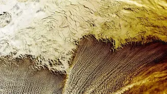
Observing the Arctic is notoriously difficult. Its remote, harsh environment is often shrouded in clouds or, for half the year, complete darkness. This is where Synthetic Aperture Radar (SAR) satellites, like Europe's Sentinel-1, become essential. Unlike optical satellites that need clear skies and daylight, SAR is an active sensor. It sends its own pulses of microwave radiation toward Earth and reads the signals that bounce back, creating a detailed image of the surface regardless of weather or time of day. This capability allows for the continuous, reliable monitoring crucial for tracking the rapid changes happening at the poles.
Reading the Radar
The data from SAR satellites is far more than just a picture. By comparing images taken over time, scientists use a technique called interferometry (InSAR) to detect subtle shifts in the ice surface, measured in centimetres. This allows them to see the ice breathing with the ocean tides, map the flow of glaciers, and, critically, watch as fractures and crevasses form and propagate long before a final break occurs. For the recent Petermann event, the tandem operation of two Sentinel-1 satellites provided daily data, offering an unprecedented, near-real-time view of the ice tongue's final days as it cracked and prepared to separate.
Why Greenland's Ice Matters Everywhere
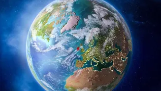
An iceberg calving in the remote Arctic may seem distant, but its implications are global. The Greenland ice sheet is the single largest contributor to global sea-level rise, and it is losing ice at an accelerating rate. If the entire sheet were to melt, global sea levels would rise by more than 7 meters, or about 23 feet. While that is a long-term scenario, the current rate of melt already affects coastal communities worldwide through increased flooding and erosion. This includes India, with its long and densely populated coastline. The freshwater pouring into the North Atlantic from melting glaciers can also disrupt major ocean currents that regulate global weather patterns.
A Clearer Picture of a Warming World
This historic ice break, and the technology used to observe it, underscores a crucial reality of our time. The Arctic is warming far more rapidly than the rest of the planet, leading to dramatic and accelerating changes. Events like the Petermann calving are no longer just isolated natural processes; they are symptoms of a larger, systemic shift. The ability of radar satellites to provide an uninterrupted stream of data is a game-changer for climate science. It allows researchers to better understand the mechanisms driving ice loss, refine their models for future sea-level rise, and provide clearer evidence of the profound impact of climate change on Earth's most vulnerable systems.