







A New Sentinel in the Sky
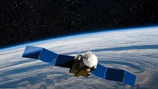
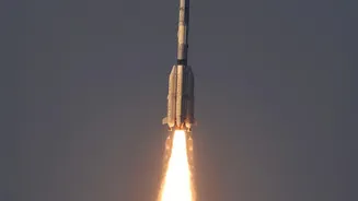
On September 4, 2026, the Indian Space Research Organisation (ISRO) successfully launched the EOS-05 satellite aboard its powerful GSLV-F17 rocket. This wasn't just another launch; it marked the arrival of a new class of satellite for India. EOS-05 is the country's
first-ever geo-imaging satellite, designed to provide continuous observation of the Indian subcontinent from a fixed position high above the Earth. Weighing approximately 2,367 kg, it is also the heaviest satellite ever launched by a GSLV rocket, showcasing ISRO's growing launch capabilities. This mission is also a story of resilience, as EOS-05 is the successor to the EOS-03 satellite, which was lost in a launch failure back in August 2021. Its successful deployment signals a major comeback and a significant step forward for India's space programme.
The Geosynchronous Advantage
The single biggest reason EOS-05 is a milestone is its orbit. Most Earth observation satellites, like those in the Cartosat or Resourcesat series, operate in a Low Earth Orbit (LEO), circling the planet from a few hundred kilometres up. While they capture incredibly detailed images, they are like fast-moving trains—they pass over a specific location for only a few minutes before disappearing over the horizon, returning only after a day or more. EOS-05, however, is being placed in a geosynchronous orbit roughly 36,000 kilometres away. At this altitude, the satellite's orbital speed matches the Earth's rotation. The effect is that it remains seemingly stationary over the same geographical area. Think of it as the difference between a passing drone capturing a single snapshot and a dedicated security camera providing a constant, unblinking watch. This allows for near-real-time monitoring of events as they unfold.
An All-Weather, 24/7 Watcher
Another key feature that elevates EOS-05 is its advanced instrumentation. The satellite is equipped with Synthetic Aperture Radar (SAR), a powerful imaging technology that gives it a crucial advantage over traditional optical cameras. Unlike optical sensors that rely on sunlight and clear skies, SAR is an active system that sends out its own radar pulses and reads the echoes. This means EOS-05 can 'see' through clouds, fog, and smoke, and can capture high-resolution images both day and night. This all-weather, 24/7 capability is a game-changer, especially for a country like India that experiences heavy monsoon seasons. During critical events like cyclones or floods, when cloud cover is thickest, EOS-05 will still be able to provide clear and consistent data to authorities on the ground.
Transforming Disaster Management and More
The practical applications of this new capability are vast and vital for India's national interests. In disaster management, the ability to monitor a cyclone's formation, track its path in real-time, or assess the extent of flooding as it happens is invaluable for issuing timely warnings and deploying rescue teams effectively. For agriculture, the satellite can monitor crop health, soil moisture, and the impact of weather patterns across large areas, aiding in policy planning and food security. Beyond these civilian uses, EOS-05 provides a significant strategic advantage. A persistent 'eye in the sky' enhances India's surveillance capabilities, allowing for the monitoring of borders and maritime areas with unprecedented frequency. This dual-use nature—serving both civilian and strategic needs—makes EOS-05 a truly national asset.