


What Is a 'Normal' El Niño?
El Niño is one-half of the El Niño-Southern Oscillation (ENSO), a natural climate cycle centred in the tropical Pacific Ocean. In a typical year, trade winds blow from east to west, piling up warm surface water near Asia. During an El Niño, these winds weaken
or even reverse. This allows the massive pool of warm water to slosh back eastward, towards South America. This fundamental shift in ocean heat releases a tremendous amount of energy into the atmosphere, altering weather patterns globally. It often brings droughts to Australia and Indonesia, while causing heavy rainfall in parts of the Americas and East Africa. This cycle naturally occurs every two to seven years and is a major driver of climate variability around the world.
This Year's Powerful Anomaly
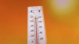
The current El Niño is anything but normal in its intensity. Forecasts suggest it is on track to be one of the strongest events since records began in 1950. Sea surface temperatures in the key monitoring region of the Pacific are already multiple degrees above average, with some pockets of water registering more than 4 degrees Celsius warmer than usual. This event is unfolding on a planet already supercharged by background warming from human-caused climate change. The combination of this powerful natural cycle with an already overheated ocean is amplifying risks and leading to predictions of record global temperatures through 2027.
The 'New Kind' of El Niño Debate
For years, climate scientists have debated whether global warming is changing the nature of El Niño itself. One prominent idea is the emergence of a different 'flavour' of El Niño, often called 'El Niño Modoki' (a Japanese term for 'similar, but different') or a Central Pacific El Niño. Unlike a traditional El Niño where warming is concentrated in the eastern Pacific near South America, a Modoki event sees the warmest water anomalies parked in the central Pacific. This geographical shift changes how the atmosphere responds, altering the location of droughts and floods globally. Some research suggests these Modoki events have become more frequent in recent decades.
A Question of Data and Distinction
This is where the headline's caution comes in. A single, powerful event—even one as strong as this—is not enough to prove a permanent shift in the climate system. Scientists must distinguish between an unusually large but natural swing and a lasting change to the underlying cycle. Climate is inherently noisy, full of variability. Declaring a 'new kind' of El Niño requires a long-term trend, not just one or two powerful examples. Furthermore, the scientific community is still debating how best to measure these events in a warming world. Organisations like NOAA now use indices that try to filter out the background effect of global warming to better compare modern events to historical ones, but the science is still evolving.
What This Means for India
For India, the distinction between El Niño types is critical. The phenomenon is often linked to weaker monsoon rainfall, as seen with the deficit in 2026. However, the impact is not straightforward. Some research suggests that El Niño Modoki events—with their central Pacific warming—may suppress the Indian monsoon more severely than traditional events because of how they alter air circulation patterns over the subcontinent. Conversely, a strong traditional El Niño can sometimes be associated with more winter precipitation in northwest India. The increasing complexity, with strong El Niños occurring in a warmer world, means India faces a more uncertain future of both potential droughts and extreme, localized downpours.