


A New Pair of Eyes on the Ice
Scientists have unveiled a powerful new tool for peering deep inside Earth's massive ice sheets. The technology comes from the NASA-ISRO Synthetic Aperture Radar (NISAR) satellite, a joint mission between the United States and India. Unlike standard optical
satellites that see the world as our eyes do, NISAR uses radar, which can penetrate clouds, operate day or night, and, most importantly, see through snow and into the ice itself. This capability is transforming our understanding of these critical, remote regions by revealing the internal plumbing of glaciers and ice sheets in stunning detail. The technology works by sending polarized microwave signals to the surface and analysing what bounces back.
Decoding the Colours: Green vs. Magenta
The striking images produced by this new system are not just beautiful; they are rich with data. The colours represent different properties of the ice, revealed by how the radar signals interact with it. Magenta tones highlight areas where the radar signal bounced off a smooth, regular surface, indicating solid, less-disturbed ice. In contrast, the vibrant green areas show where the signal scattered in multiple directions. This happens when it encounters rough, uneven features like the deep walls of crevasses or other complex structures within the ice. White areas signify a strong mix of both signal types, suggesting a blend of smooth and fractured ice characteristics. This colour-coding gives scientists an immediate, intuitive map of the ice's structural integrity.
Why Mapping Crevasses is Critical
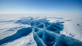
Crevasses are more than just cracks in the ice; they are fundamental to how glaciers behave. These fractures are zones of weakness that dictate how ice flows, where it accelerates, and how it ultimately breaks apart to form icebergs—a process known as calving. By precisely mapping these features, scientists can build much more accurate models of ice sheet dynamics. These models are essential for predicting how quickly the ice sheets in Antarctica and Greenland will melt and contribute to global sea-level rise. Understanding the stability of these massive ice bodies is one of the biggest challenges in climate science, and this technology provides a vital piece of the puzzle.
Safer Science and Better Predictions
Beyond its large-scale climate applications, this detailed mapping has an immediate practical benefit: safety. Scientific teams conducting research on the ground in Antarctica and Greenland face constant danger from hidden crevasses, which can be hundreds of feet deep and completely obscured by snow bridges. Having a detailed map of these hazards before a traverse can be the difference between a successful mission and a catastrophic accident. The technology, developed by research groups like the Center for Remote Sensing of Ice Sheets (CReSIS), has been refined over years through projects like NASA's Operation IceBridge, which used aircraft to test and deploy similar radar systems. The satellite-based NISAR mission now expands this capability to a global scale with a rapid 12-day repeat cycle.
An India-US Collaboration for the Planet
The NISAR mission is a landmark collaboration, combining expertise from both NASA and the Indian Space Research Organisation (ISRO). It is the first satellite mission to use dual-frequency L-band and S-band radar to systematically map Earth, offering an unprecedented view of changes in our planet's land and ice surfaces. While one recent image from Antarctica captured public imagination for resembling a hummingbird, its scientific value is far more profound. It represents a new era in Earth observation, where we can monitor the health of our planet’s iciest regions with a clarity that was previously impossible, helping communities worldwide prepare for the impacts of a changing climate.