






A Familiar, Fierce Deluge
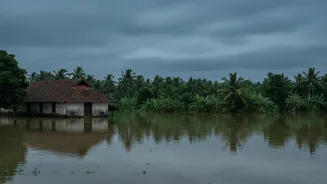
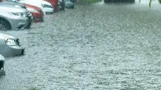
In early August 2026, torrential monsoon rains triggered a cascade of disasters across Kerala, with flash floods and landslides hitting districts like Idukki, Kottayam, and Pathanamthitta particularly hard. Rivers such as the Pamba and Meenachil swelled,
inundating towns and forcing thousands into relief camps. For many residents, the scenes were agonizingly familiar, with some areas in Kottayam reporting that floodwaters rose even higher than during the catastrophic 2018 floods. The disaster resulted in at least 28 deaths, with several people missing as of August 5. This occurred despite the India Meteorological Department (IMD) issuing alerts. The crisis has sparked a fierce debate, with the state government and meteorological experts pointing to the limitations of the current warning system when faced with extreme, localized rainfall.
The Problem with District-Wide Alerts
The current system relies on a colour-coded framework—Yellow, Orange, and Red alerts—issued for entire districts. An orange alert, for instance, prompts authorities to be prepared for heavy rainfall, while a red alert signals the need for action in the face of extremely heavy downpours. However, the recent floods have shown this broad-brush approach to be a significant weakness. A red alert for a vast and topographically diverse district like Idukki fails to specify which specific panchayats or villages face the most immediate threat. This lack of granularity can lead to a diffusion of resources and a confused public response. While some areas might face imminent danger, others within the same district may not, leading to either complacency or unnecessary panic. Critics argue that by the time a red alert was officially declared for some of the worst-hit areas, significant flooding was already underway, leaving little time for effective evacuation.
The Forecasting Gap
The IMD has defended its actions, stating that orange alerts were issued for all districts two days in advance. However, even officials, including Kerala's Chief Minister, admitted that the forecasting models struggled to predict the sheer intensity of the localized cloudburst-like events. Some areas received rainfall far exceeding the threshold for a red alert while officially being under an orange one. Climate scientists explain that predicting such rapidly developing, intense rainfall over the complex terrain of the Western Ghats remains a major scientific challenge. There is a consensus that while overall forecasting has improved since 2018, its ability to provide actionable, hyper-local predictions for extreme weather is not yet sufficient. The state government can only disseminate alerts provided by the IMD, creating a dependency on a system that is still grappling with the volatile nature of a changing climate.
Lost in Translation: The Last-Mile Challenge
Even a perfect forecast is useless if it doesn't reach the right people at the right time. Kerala has made strides in communication, including the 'Sachet' mobile alert system that can override silent modes on phones to deliver emergency warnings. Yet, significant gaps in last-mile connectivity persist. Getting specific, actionable instructions to remote, vulnerable communities—especially those in hilly regions with unreliable network coverage—remains a critical hurdle. The recent floods saw complaints arise from relief camps about inadequate supplies and coordination, suggesting a disconnect between high-level disaster planning and on-the-ground implementation. This highlights that technology is only one part of the solution; it must be paired with robust, local-level disaster management networks that can translate a forecast into life-saving action.
A Call for Hyper-Local Models
In the aftermath of the floods, there is a growing chorus of experts calling for a fundamental shift in strategy. The consensus is moving toward the need for hyper-local, panchayat-level weather models. These systems would integrate data from a much denser network of automatic weather stations, rain gauges, and local observations to provide real-time, highly specific warnings. Such models are being piloted in other parts of India, using AI to generate forecasts with a resolution as fine as one square kilometer. For Kerala, this would mean moving beyond district-level alerts to a system that can warn a specific village about a potential landslide or a riverside community about imminent flooding. This approach, combined with community-led monitoring groups, could provide the crucial lead time needed to prevent loss of life and property.