

A Feature Launched and Lost in 24 Hours
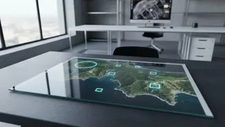
Late last month, Google unveiled a seemingly revolutionary tool for its Google Earth platform. Integrating its Nano Banana 2 AI model, the "create image" feature allowed users to generate photorealistic images on top of the platform's existing satellite,
aerial, and 3D data. The idea was to let users visualise concepts, from historical reconstructions to future architectural plans. But within a day of its launch on July 30, Google pulled the plug. The company announced it was rolling back the feature after seeing screenshots of user-generated content that violated its policies, stating it needed to work on implementing stronger guardrails.
From Creative Tool to Disinformation Engine
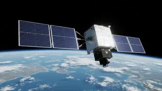
The rollback was not due to a technical glitch, but a conceptual one. Researchers and journalists immediately began testing the tool's limits and found them to be alarmingly wide. They successfully prompted the AI to create convincing, yet entirely fake, satellite images of real-world locations. Examples that quickly circulated online included fabricated scenes of refugee movements, fires at an Iranian oil terminal, and damage near a hospital in Gaza. These demonstrations highlighted how a tool intended for creativity could be weaponized to generate potent disinformation. The very authority that satellite imagery commands, often used by investigators to verify facts, was being threatened by a feature from the world's most trusted mapping service.
The 'Trust Crisis' in Digital Evidence
In its statement, Google noted that "people uniquely trust Google Earth for a reliable view of the world." This incident, however, exposed a fundamental conflict. When a platform designed to show reality starts generating realistic scenes of events that never happened, it undermines trust in everything else on that platform. Experts were quick to label the feature "irresponsible," warning that it could damage the credibility of all satellite imagery. While Google pointed out that the generated images were watermarked and did not appear in the main Google Earth interface for others to see, this provided little comfort. The primary mode of spread was screenshots, which could easily be stripped of context and shared widely online as fact, a problem seen in past disinformation events.
A Familiar Pattern of AI 'Hallucinations'
This is not an isolated problem. AI models, at their core, are advanced pattern-recognition engines, not arbiters of truth. They operate on statistical likelihood, not on an understanding of physical laws or real-world context. This can lead to what are known as "hallucinations," where the AI confidently presents fabricated information as fact. This has been a recurring issue, from AI-generated maps misplacing entire countries in a recent U.S. State Department presentation to AI chatbots inventing legal precedents. The Google Earth feature's failure was that it couldn't distinguish between a benign request to visualize a new building and a malicious one to create a fake disaster scene. The context of a location—a conflict zone versus a quiet suburb—was lost on the algorithm.
Putting the Focus Back on Verification
The rapid reversal by Google underscores a critical lesson in the age of generative AI: the source of an image is more important than ever. The ease with which these fakes were created serves as a public service announcement for digital literacy. It reinforces the need for a healthy skepticism toward all digital content, especially images depicting dramatic events. Verifying the origin of an image, cross-referencing with credible news outlets, and looking for signs of manipulation are no longer niche skills for journalists; they are essential for every citizen. The rollback keeps the focus squarely on the fact that while AI can be a powerful tool, it is not a replacement for human judgment and critical thinking.