



The Planet’s Natural Heat Engine
To understand what’s happening, we first need to talk about the El Niño-Southern Oscillation, or ENSO. Think of it as a massive, natural climate cycle centered on the tropical Pacific Ocean. For years at a time, it can be in a cool phase, called La Niña,
or a neutral phase. But every few years, it flips into its warm phase: El Niño. During an El Niño, trade winds that usually blow east to west across the Pacific weaken. This allows a huge volume of warm water, normally piled up in the western Pacific, to slosh back eastward. This vast expanse of warmer-than-average ocean water releases an enormous amount of heat and moisture into the atmosphere. Because the Pacific Ocean is so immense, this process is powerful enough to temporarily raise the entire planet's average temperature and disrupt weather patterns around the globe.
A Perfect Storm for Record Heat
This isn't just any El Niño. Forecasts from the World Meteorological Organization and other climate centers in mid-2026 indicate that the current event is developing rapidly and has the potential to become one of the strongest on record. This natural warming burst is happening on top of a planet already warmed by more than a degree due to human-caused climate change. The combination is potent. The background warming provides a higher starting point, and the El Niño provides the extra push. Scientists note that the peak effect of El Niño on global air temperatures often lags behind the peak in ocean warming by several months. This means an event that strengthens through late 2026 is most likely to show its full force on the global thermometer in early 2027.
What a 2°C Month Really Means
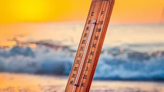
The 2-degree threshold is a major figure in climate discussions, but context is everything. Projections from atmospheric research centers now suggest there's a significant chance—as high as 40 percent—that a single month in 2027 could breach this 2°C barrier. It would be a historic and sobering moment, the first time in recorded history that humanity has experienced such a milestone. However, it is crucial to understand that this is a temporary spike, not a permanent state. This is weather, supercharged by a natural cycle, riding on top of a long-term climate trend.
A Warning, Not a Permanent Failure
Crossing 2°C for one month does not mean the world has failed to meet the Paris Agreement goal. That international accord aims to keep the long-term, multi-decade average temperature rise "well below" 2°C. A sustained average at that level would lead to catastrophic and irreversible consequences, from devastating sea-level rise to the collapse of major ecosystems. A brief monthly spike, driven by El Niño, is different. It’s best seen as a loud and clear warning shot from the climate system. It gives us a terrifying preview of what a permanently warmer world could feel like, showing just how close we are to dangerous tipping points. It demonstrates that the buffer we once had to absorb natural climate swings is shrinking.
From Global Average to Local Reality
While a "global average temperature" can feel abstract, the effects of a strong El Niño are very real. This phenomenon is notorious for causing climate chaos. For some regions, it means severe drought, increased risk of wildfires, and stress on agriculture. For others, it brings torrential rainfall and devastating floods. The added heat from this El Niño will likely intensify heatwaves and extreme weather events already expected for 2027. These local and regional impacts are where a global temperature spike translates into tangible risks for communities, economies, and food security.