









Beyond the Fastest Route
Our reliance on GPS and digital maps has fundamentally changed how we move through the world. We implicitly trust these systems to steer us clear of traffic jams, find the shortest path, and estimate our arrival time with increasing accuracy. This optimisation,
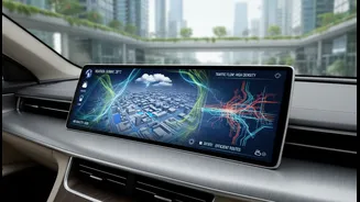
however, has always been one-dimensional, focused almost exclusively on time and distance. But the definition of an optimal route is beginning to expand. The next frontier for navigation technology is the integration of rich, real-time environmental data. This shift promises to transform our daily travel from a simple calculation of speed into a multi-layered decision that balances efficiency with well-being and environmental impact. It’s a move from finding the quickest path to finding the smartest, healthiest, and most sustainable one.
What is Environmental Data?
When we talk about 'environmental data' in this context, it's more than just weather forecasts. It's a granular, hyperlocal stream of information that paints a detailed picture of the conditions on and around the road. This includes real-time air quality metrics, such as levels of PM2.5, NOx, and ozone, which are particularly relevant in India's densely populated cities. It also covers noise pollution levels, road gradients, and even pollen counts. Companies are developing algorithms that can incorporate these layers, offering what is often called 'eco-routing' or 'green navigation'. In a country like India, this could also be expanded to include data on road surface quality—avoiding pothole-ridden stretches—or areas prone to seasonal waterlogging, providing a much more realistic and comfortable travel plan.
The Benefits of a Greener Path
The advantages of this enriched navigation are compelling for both individuals and society. For the daily commuter, it means the ability to choose a route that avoids passing through a pocket of severe air pollution, potentially reducing long-term health risks. For commercial fleets, eco-routing algorithms can create significant fuel savings by suggesting routes that minimise harsh acceleration and braking, avoid steep inclines, and bypass stop-and-go traffic. Studies have shown that these optimised routes can reduce fuel consumption and emissions by a significant percentage. On a city-wide scale, this data becomes an invaluable tool for urban planners. By understanding pollution patterns and traffic-induced environmental stress, authorities can make more informed decisions about infrastructure development, traffic management policies, and the creation of low-emission zones.
The Technology Driving the Change
This evolution is being powered by the convergence of several key technologies. The Internet of Things (IoT) is crucial, with an expanding network of low-cost sensors being deployed on vehicles, lampposts, and buildings to collect the necessary environmental data. Artificial Intelligence (AI) and machine learning algorithms are then used to process this massive, complex dataset, identify patterns, and make predictive routing suggestions in real time. Several tech companies, from startups to giants like Google and TomTom, are actively developing these capabilities. Google has already started integrating hyperlocal air quality data into its Maps platform in India, using a combination of government data, sensor readings, and AI modeling. TomTom's systems focus on smarter routing to avoid congestion, which directly reduces fuel burn and CO2 spikes from stop-start driving. This integration of AI and real-time data is the engine of next-generation navigation.
Hurdles on the Road Ahead
Despite the promise, the path to fully integrated environmental navigation has its challenges. The primary hurdle is data acquisition and accuracy. Deploying and maintaining a dense enough network of reliable sensors to provide truly hyperlocal data across vast urban and rural landscapes is a massive undertaking. Standardisation is another issue; ensuring that data from different sources is consistent and comparable is essential for the system to work. Furthermore, there are significant computational demands in processing this continuous stream of information and calculating optimal routes for millions of users simultaneously. Finally, as with any data-intensive technology, questions around data privacy and security must be addressed to build public trust. Who owns the environmental data collected from a person's vehicle, and how is it used?