






An Unprecedented Downpour
The core of the recent crisis was not just the amount of rain, but the incredible speed at which it fell. Meteorologists refer to this as rainfall intensity. In early August 2026, Kerala received staggering amounts of rain in very short periods, with
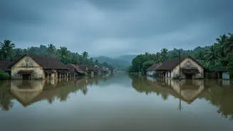
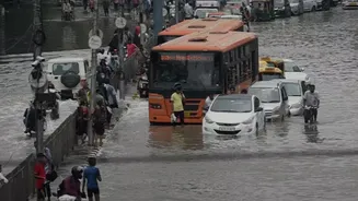
some areas recording near-cloudburst conditions. For example, Kerala received over three times its seasonal average rainfall between July 31 and August 2. One gauge in Pathanamthitta recorded 361 mm in just twenty-four hours. This pattern is part of a worrying trend where the monsoon is not just bringing rain, but delivering it in violent, concentrated bursts. When rain falls this fast, it immediately overwhelms natural and man-made drainage systems. Instead of soaking into the ground, the water becomes instant surface runoff, turning streets into rivers and inundating low-lying areas within hours.
The Challenge of the Terrain
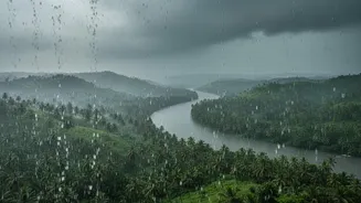
Kerala's geography plays a critical role in how it experiences floods. The state is a relatively narrow strip of land between the Arabian Sea and the high mountains of the Western Ghats. Most of its rivers are short, steep, and fast-flowing, originating in the Ghats and rushing towards the sea. During a normal monsoon, this system works. But during an extreme rainfall event, this same topography becomes a liability. The steep slopes of the Western Ghats act like a funnel, collecting the massive volume of water and accelerating its journey downhill. This rapid runoff from the high ranges surges into the rivers, causing them to breach their banks and flood towns and villages downstream. The fragile, weathered rock and soil on these slopes, often disturbed by construction and agriculture, become dangerously unstable, leading to catastrophic landslides that compound the disaster.
A Landscape Already Soaked
The third critical factor was the condition of the ground before the most intense rains began. The soil in the Western Ghats acts like a sponge, absorbing rainfall during the monsoon. However, there's a limit to how much it can hold. When there are prolonged periods of rain, the ground becomes saturated. At this point, the soil can no longer absorb water, and its internal structure weakens. Any subsequent rain, even a moderate shower, has nowhere to go but to flow over the surface, dramatically increasing the volume of floodwaters. This is particularly dangerous for triggering landslides. When water saturates the soil, it builds up pressure and lubricates the boundary between the topsoil and the bedrock beneath. This can cause entire hillsides to suddenly give way, resulting in the deadly debris flows seen in districts like Idukki and Kottayam.
A Deadly Combination
Ultimately, the 2026 disaster was not the result of a single cause but the lethal interplay of all three factors. The ground, already saturated from prior rainfall, had lost its capacity to act as a natural buffer. Then, exceptionally intense, short-duration rain fell upon this soaked landscape. Kerala's steep terrain did the rest, taking this massive volume of runoff and sending it hurtling down into the plains, overwhelming rivers and triggering landslides. While improved warning systems have been put in place since previous floods, experts argue that these events show how ecological degradation and flawed land-use policies have reduced the landscape's natural resilience. The shrinking of wetlands and paddy fields, which once absorbed floodwaters, has further worsened the situation.