





A Sudden, Devastating Deluge
On what began as a normal morning, communities along the Bhotekoshi and Trishuli rivers in Nepal were engulfed by a sudden, violent flood. The surge was not preceded by heavy local rainfall, a fact that baffled residents and first responders. Videos captured
a horrifying wall of dark, debris-filled water, moving with immense force, sweeping away buildings, bridges, and anything in its path in popular tourist areas like Syapru Besi. The event was so powerful it was initially mistaken for a magnitude 4.4 earthquake, but the seismic signals were later identified by the U.S. Geological Survey as having been generated by a massive landslide and glacial collapse, not a tectonic event.
The View from Space: A Scientific Investigation
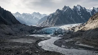
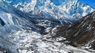
With the source of the flood unclear, an international team of scientists turned to the sky for answers, analyzing high-resolution satellite imagery from companies like Planet Labs. Initial images were obscured by dust and clouds, but clearer views soon revealed a catastrophic scene high in the Himalayas. Geologists and glaciologists pinpointed a massive scar on a mountain near the Nepal-Tibet border. Before-and-after images showed that a huge section of a glacier, estimated to be over 600 metres wide, had detached and collapsed from an altitude of around 17,000 feet.
Anatomy of a Disaster: The Tibetan Connection
The scientific consensus points to a complex sequence of events originating in Chinese-administered Tibet. It began when a massive section of bedrock beneath a glacier failed, causing the ice and rock to collapse and plummet nearly 4,000 feet into the valley below. The sheer force of this ice avalanche pulverized the ice into water and generated a powerful air blast. This torrent of debris then likely blocked the Lhende Khola river, which marks the border. Water rapidly accumulated behind this natural dam before bursting through, sending the catastrophic flood surge downstream into Nepal.
A 'Ticking Clock' in the World's Rooftop
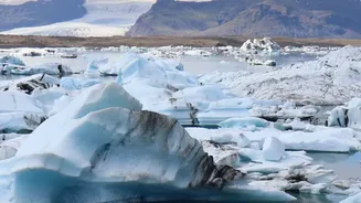
This event is a stark illustration of a growing threat known as Glacial Lake Outburst Floods (GLOFs) and other cryospheric hazards. The Himalayas, which hold the largest volume of ice outside the polar regions, are warming at nearly twice the global average. As glaciers retreat at an accelerating pace, they leave behind vast lakes, often held in place by unstable natural dams of rock and debris called moraines. These lakes, along with the glaciers themselves, are becoming increasingly unstable. Events like rockfalls, avalanches, or even rapid melting can trigger collapses or dam breaches, releasing millions of cubic metres of water in minutes. Scientists have warned for years that a GLOF was a matter of when, not if, in many parts of the region.
The Urgent Need for Cross-Border Cooperation
Because the flood originated in one country and caused devastation in another, the disaster highlights a critical gap in regional preparedness. Experts have urgently called for the establishment of a transnational early warning system. Information about hazards in the high Himalayas, such as the glacial collapse, is often only available to the Chinese side. Without a formal mechanism to rapidly share this data, downstream nations like Nepal and India are left vulnerable. Experts argue that even a few minutes of advance warning could be enough to save lives, allowing for evacuations. While some community-based warning systems exist, they are not equipped to handle a hazard that begins, undetected, across a national border.