


A Look Back at the Tragedy
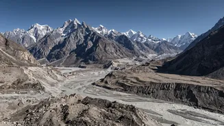
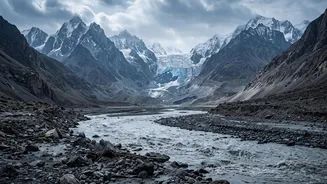
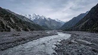
On the morning of February 7, 2021, a massive torrent of water, mud, and debris surged through the Rishi Ganga and Dhauliganga river valleys in Uttarakhand's Chamoli district. The flash flood was sudden and catastrophic, obliterating everything in its
path, including two major hydropower projects and the lives of over 200 people. In the immediate aftermath, the cause was a mystery. Early theories suggested a glacial lake outburst flood (GLOF), where a natural dam holding back a glacial lake gives way. However, as scientists began to piece together the evidence, a different and more complex picture started to emerge.
An Unsolved Scientific Puzzle
While it quickly became clear that a landslide was involved, initial analyses struggled to explain the sheer violence and timing of the flood. What exactly triggered the event on a clear winter morning? And how did a mass of rock and ice transform into a destructive flood wave so quickly? Eyewitness accounts described a loud crack followed by a huge plume of dust before the water arrived, hinting at an event high in the mountains. The challenge for scientists was to forensically reconstruct the first few moments of the disaster to understand the primary trigger, a crucial step for predicting and mitigating similar events in the future. The lingering question was not just what happened, but precisely how and when each stage unfolded.
The 'Ice-Rock Fall' Hypothesis
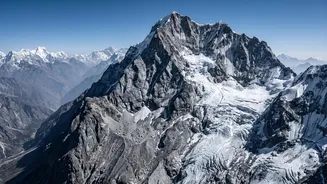
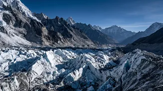
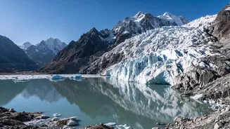
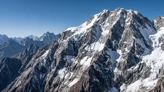
Recent scientific analysis now points to a more specific chain of events, providing a stronger link between the flood's timing and a singular event. A colossal block of rock, mixed with glacier ice, detached from the steep slopes of Ronti Peak. According to studies, this mass was enormous, estimated at around 27 million cubic metres. The key finding is that this was not just a landslide but an ice-rock avalanche. The incredible height of the fall—over 3,200 metres—generated immense energy. This energy, through friction and heat, melted the 20% of ice contained within the debris almost instantly, providing the massive volume of water that initiated the flash flood.
Reading the Seismic Echoes
To confirm the timing, scientists turned to an unconventional source: seismic data. The impact of the ice-rock avalanche hitting the valley floor was so powerful that it registered on seismometers, essentially creating a geological fingerprint of the event. By analysing these seismic waves, researchers could pinpoint the exact moment of the collapse. This data, combined with satellite imagery captured before and after the event, allowed them to create a timeline with unprecedented accuracy. The evidence confirmed that the avalanche occurred just moments before the flood began its destructive journey downstream, ruling out the slower-moving GLOF theory and cementing the ice-rock fall as the primary, instantaneous trigger. This analysis transformed the event from a confusing natural disaster into a well-defined, albeit complex, physical process.
Implications for a Fragile Region
Understanding the precise cause of the Chamoli disaster is more than an academic exercise. The Himalayas are warming at an accelerated rate, making its glaciers and permafrost—the frozen ground that holds many steep slopes together—increasingly unstable. Events like the one in 2021, and a similar recent tragedy in Nepal, are now understood to be part of a new and growing threat where rock and ice avalanches can trigger floods without the traditional warning signs of heavy rain or overflowing glacial lakes. This new research underscores the urgent need for updated hazard assessments and monitoring systems in the high mountains, focusing on geological instability as much as on weather patterns. By understanding these cascading hazards, authorities can be better prepared to protect the vulnerable communities living in the shadow of the world's tallest, and most fragile, mountain range.