







Akvan: The Latest Threat
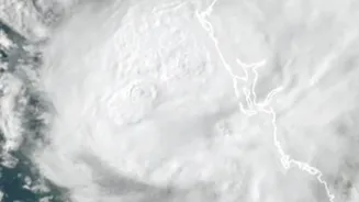
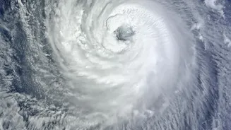
The latest system to capture headlines is Cyclone Akvan, which has intensified into a severe cyclonic storm. According to the India Meteorological Department (IMD), Akvan is projected to strengthen into a very severe cyclonic storm and make landfall along
the Andhra Pradesh coast around November 20. Authorities have issued an orange alert for the Andhra Pradesh and adjoining south Odisha coasts, forecasting extremely heavy rainfall and wind speeds that could reach 120-130 kmph, with gusts up to 145 kmph. This follows closely on the heels of Cyclone Murasu, which made landfall in Andhra Pradesh around November 3, and Cyclone Arnab, which hit the same state in late October. The rapid succession of these storms has put immense pressure on disaster management authorities, who are dealing with restoration work from the previous cyclones even as a new threat looms.
What’s In A Name?
The names Murasu, Arnab, and Akvan are not chosen at random. They are part of a systematic process coordinated by the World Meteorological Organization (WMO) and regional bodies. For the North Indian Ocean, which includes the Bay of Bengal and the Arabian Sea, a panel of 13 member countries proposes names. These names are then arranged in a sequential list. A storm is officially named once it intensifies into a cyclonic storm with wind speeds of 62 km/h or more. 'Arnab', meaning 'ocean' in Bengali, was a name contributed by Bangladesh. 'Murasu', the Tamil word for a traditional drum, was proposed by India. 'Akvan', the name for the current storm, was suggested by Iran and has roots in Persian mythology. This system helps in identifying storms, disseminating warnings, and avoiding confusion when multiple weather systems are active in the same basin.
A Region on High Alert
With Akvan approaching, state governments in Andhra Pradesh and Odisha are in a full state of preparedness. Special relief commissioners have directed collectors in vulnerable districts to take all precautionary measures. Disaster response teams from the National Disaster Response Force (NDRF) and Odisha's ODRAF are on standby for strategic deployment. Evacuation plans are being activated, particularly for those in low-lying coastal areas, landslide-prone zones, and kutcha houses. Authorities are also ensuring that cyclone shelters are ready with adequate supplies of food, water, and medicine, and have backup power arrangements. Fishermen have been repeatedly warned to stay ashore until the sea conditions improve. The focus remains squarely on the 'zero casualty' policy that states like Odisha have successfully implemented during past cyclones.
The Bay of Bengal's New Normal
The Bay of Bengal has always been a hotbed for cyclonic activity, accounting for about four times as many cyclones as the Arabian Sea. Its funnel-like shape, warmer sea surface temperatures, and high moisture content create the perfect breeding ground for these massive storms. While a cluster of storms in the post-monsoon season (October-December) is not unusual, scientists are increasingly concerned about their intensity. Research suggests that rising ocean temperatures due to climate change may be contributing to the rapid intensification of cyclones, allowing them to become severe or very severe in a short span. While studies show a slight decrease in the overall frequency of cyclones in the Bay of Bengal, the trend towards more powerful and destructive storms poses a growing challenge for millions living along India's eastern coast.