






High in the Himalayas, a silent threat is growing. As glaciers melt, they are forming thousands of unstable lakes, veritable water bombs waiting to devastate downstream communities. Now, researchers are issuing an urgent call for action.
The Ticking Time Bombs in the 'Third Pole'
The Himalayan
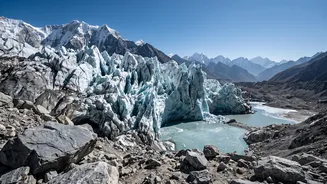
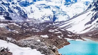
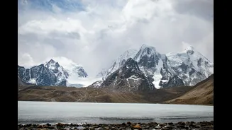
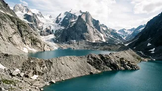
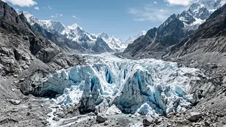
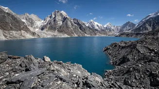
region, often called the ‘Third Pole’ for its vast ice reserves, is warming faster than the global average. This accelerated melting is creating thousands of glacial lakes, many of which are held back only by unstable natural dams made of loose rock and debris known as moraines. When these dams fail, they can trigger a Glacial Lake Outburst Flood (GLOF), a catastrophic event that sends a tsunami-like wall of water, mud, and boulders down the mountain. Recent disasters, like the 2023 South Lhonak Lake flood in Sikkim which claimed dozens of lives and wiped out a major hydropower plant, serve as devastating reminders of this threat. According to a 2025 assessment by the National Disaster Management Authority (NDMA), at least 56 glacial lakes in the Indian Himalayan Region are classified as 'very high risk'.
Why Monitoring Just the Lake Isn't Enough
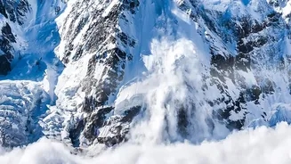
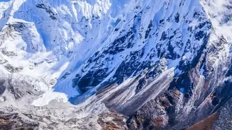
Traditionally, monitoring efforts have focused on the glacial lakes themselves. However, a growing body of research argues this approach is dangerously insufficient. Recent disasters have shown that floods often begin not at the lake, but high on unstable mountain slopes from rock and ice avalanches that cascade into the water below. This creates a chain reaction that is missed by lake-only monitoring. Researchers are now urging a shift towards monitoring the entire 'flood pathway'. This involves using a combination of satellite imagery, seismic sensors, and on-ground instruments to watch for signs of instability across the entire potential route of a flood, from high-altitude slopes to the river valleys below. The goal is to detect not just a swelling lake, but also the landslide or avalanche that could trigger its collapse in the first place.
The Technology of a Lifeline
A comprehensive early warning system (EWS) is a multi-layered lifeline. It starts with technology like automatic weather stations and water-level sensors installed at high-risk lakes, providing a continuous stream of real-time data. This is combined with remote sensing via satellite to track changes in lake size, glacier movement, and ground stability over wide areas. When a potential trigger is detected, sophisticated models can simulate the potential flood path and impact zone. The final, and most critical, step is 'last-mile connectivity': ensuring the warning reaches vulnerable communities in time through sirens, mobile alerts, and trained local volunteers. International collaborations, such as a pilot project in Sikkim supported by the Swiss Agency for Development and Cooperation, are already demonstrating how this technology can work in practice.
The Immense Challenges on the Ground
Implementing these systems across the Himalayas is a monumental task. The terrain is among the most rugged and inaccessible on Earth, making the installation and maintenance of sensitive equipment extremely difficult and expensive. Many vulnerable valleys lack reliable mobile or satellite connectivity, creating significant hurdles for data transmission and communication. Furthermore, there is a need for greater institutional coordination between the various scientific and governmental agencies that handle geology, weather, and disaster response. Recent disasters in Nepal have also highlighted that because many Himalayan rivers cross national borders, a flood starting in one country can devastate another, making transboundary data sharing and cooperation essential for effective warnings.
A Race Against a Melting Clock
The urgency of this situation cannot be overstated. With climate change driving accelerated glacier retreat, the number and size of dangerous glacial lakes are increasing, with some studies showing lakes expanding by as much as 400% over a few decades. The danger is not static; it is actively growing. In July 2026, the Indian government informed Parliament that it was monitoring nearly 2,500 glacial lakes. While a National GLOF Risk Mitigation Programme is in place, experts stress that the focus must shift from post - disaster response to pre - disaster preparedness. This requires not only investing in the technology for broader pathway monitoring but also empowering local communities with the knowledge and training to respond to warnings. It is a complex , costly , and difficult challenge , but one that is essential for safeguarding the lives and livelihoods of millions living in the shadow of the mountains.