



The Old Picture of Polar Melt
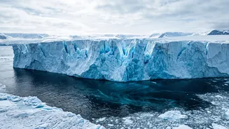
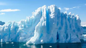
To predict how much our oceans will rise, scientists rely on complex computer models. For Antarctica, these models have long tried to simulate how warming ocean waters melt the continent's enormous floating ice shelves from below. These shelves act like
a cork in a bottle, holding back the colossal glaciers behind them. The general understanding was that a layer of cold, fresh meltwater near the ice base would slow down the melting process by acting as a barrier against warmer, saltier ocean water deeper down. While scientists knew that glaciers like West Antarctica's Thwaites—nicknamed the 'Doomsday Glacier' for the catastrophic impact its collapse could have—were retreating, the models provided a certain timeline for this process. Previous estimates suggested Thwaites would contribute about 15 millimetres to global sea-level rise by the year 2100.
A Hidden Threat Revealed
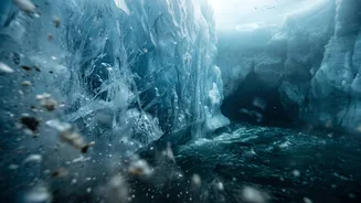
Recent research has uncovered a hidden process that dramatically changes this picture. Scientists have found that the undersides of these massive ice shelves are not smooth. They are carved with deep channels and crevasses, some stretching for many kilometres. New studies, including one focusing on the Thwaites Glacier, show that these channels act like pipelines, funneling warm, dense ocean water far inland. This process, sometimes called 'tidal pumping', allows the warm water to bypass the protective layer of colder freshwater and attack the base of the ice where it is most vulnerable: the grounding line. This is the critical point where the glacier loses contact with the seabed and begins to float. By concentrating intense melting at these weak points, the entire ice shelf is destabilised much faster than older models predicted. Melt rates within these cracks and channels can be an order of magnitude higher than on the flat parts of the ice base.
Why Older Models Got It Wrong
The simple reason older models missed this is a lack of data. The area beneath Antarctica's floating ice shelves is one of the most inaccessible environments on Earth. For a long time, models had to rely on assumptions, treating the underside of the ice as a relatively uniform, flat surface. It was only with the advent of new technologies, like robotic underwater vehicles such as 'Icefin' and advanced satellite measurements, that scientists could get a detailed look at what was really happening. These tools have allowed researchers to map the complex topography of both the ice base and the seafloor beneath it, revealing the channels and cracks that serve as conduits for warm water. This new, more detailed information shows that the interaction between the ocean and the ice is far more dynamic and complex than previously assumed, revealing a crucial feedback loop: more melting creates more pathways for warm water, which in turn causes even more melting.
What This Means For Our Coasts
The implications of these findings are significant. The study on Thwaites Glacier, for instance, now suggests its contribution to sea-level rise by 2100 could be up to 30 millimetres—double the previous estimate. While that may not sound like much, it is an alarming increase from a single glacier. When this accelerated melting process is factored in across Antarctica, it means that global sea-level rise projections, like those from the Intergovernmental Panel on Climate Change (IPCC), may be too conservative. For a country like India, with its extensive 7,500-kilometre coastline and hundreds of millions of people living in low-lying areas, this is critical news. Coastal cities such as Mumbai, Chennai, Kolkata, and Surat are already identified as being at high risk from rising sea levels. An acceleration in Antarctic melting would directly increase the threat of permanent inundation, more frequent and severe coastal flooding, and saltwater contamination of freshwater sources, posing a grave risk to lives, infrastructure, and the economy.