


What a 'Red Alert' Really Means
First, let's clarify what these colour-coded warnings signify. An IMD Red Alert is a call to "Take Action". It's issued when weather conditions are expected to be so severe that they pose a significant threat to life and property, often involving extremely
heavy rainfall (over 204.5 mm in 24 hours). However, this is a forecast for a region—like a district or a city—not a guarantee for every single street within it. The alert signals a high probability of dangerous weather somewhere within that broad area, urging authorities and the public to be prepared for the worst-case scenario. Think of it as a warning that a major risk exists in your general vicinity, not a promise that it will land directly on your doorstep.
The Challenge of Scale
The core of the problem lies in a mismatch of scale. Modern weather forecasting relies on powerful supercomputers running complex numerical weather prediction (NWP) models. These models divide the atmosphere into a grid system. Even with advanced technology, each grid box can cover several square kilometres. The forecast provides an average prediction for that entire box. The most intense and destructive rainfall, however, often happens in much smaller pockets—sometimes just a few square kilometres wide. A model might correctly predict that conditions are ripe for a heavy downpour within a 10x10 km grid, triggering an alert, but it can't pinpoint which specific neighbourhood will get the 200 mm deluge versus which will only get a moderate shower.
The Two Faces of Rain
Not all rain is created equal. Meteorologists distinguish between two main types: stratiform and convective. Stratiform rain is widespread, gentler, and longer-lasting, originating from large, layered clouds. It's relatively easier to forecast because it covers a vast area. Convective rain, on the other hand, is the real troublemaker. It comes from tall, volatile cumulonimbus clouds, forming rapidly and unleashing intense, short-lived downpours over a very small area. These are the cloudbursts that cause sudden urban flooding. Because they develop so quickly and are highly localized, convective storms are notoriously difficult for models to predict with pinpoint accuracy in terms of exact location and timing.
Doppler Radar: A Powerful but Limited Tool
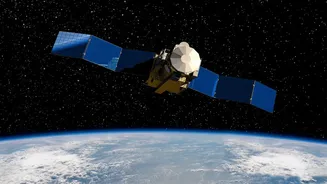
Doppler Weather Radars are essential for real-time tracking. They work by sending out microwave pulses and reading the signals that bounce off precipitation particles like raindrops. This technology is excellent for "nowcasting"—detecting where rain is currently falling and how storms are moving. However, radar has its limits. Its primary strength is in tracking existing storms, not predicting where a new, intense convective cell will form in the next hour. Furthermore, due to the Earth's curvature, the radar beam gets higher off the ground the farther it travels, potentially missing low-level weather phenomena. Gaps in the radar network, especially in complex terrain, can also create blind spots where a storm might develop undetected.
Local Geography: The Ultimate Wildcard
India's complex geography adds another layer of unpredictability. Local features like hills, coastlines, and even large urban areas can dramatically influence weather. Moist air forced up a hillside (orographic lift) can trigger intense rain on one side while leaving the other dry. Cities themselves create "urban heat islands," where warmer temperatures can alter wind patterns and, in some cases, enhance rainfall downwind. Studies have shown that over 60% of cities globally receive more rainfall than their surrounding rural areas because of these effects. These microclimates operate on a scale far smaller than what regional weather models can resolve, creating unexpected pockets of extreme weather that defy the broader forecast.