






An Inferno of Historic Scale
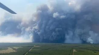
In recent weeks, southwestern France has been battling devastating wildfires, particularly in the Gironde region. Fueled by record heat, prolonged drought, and strong winds, the fires have consumed vast tracts of forest and scrubland, burning an area
several times the size of Paris. The situation became so dire that it prompted what officials have called France's largest peacetime evacuation, forcing hundreds of thousands of residents and tourists to flee their homes and vacation spots. As thousands of firefighters from across Europe mobilized to contain the inferno, the blaze took on a terrifying life of its own, ascending from a ground-level disaster into an atmospheric phenomenon.
When Fire Creates a Thunderstorm
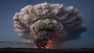
On July 24, French officials observed something their country had reportedly never recorded before: the wildfire had generated a pyrocumulonimbus cloud, or pyroCb. Often called a 'fire cloud' or nicknamed the 'fire-breathing dragon of clouds' by NASA, a pyroCb is a full-fledged thunderstorm born directly from the intense energy of a wildfire. Normally, thunderstorms form when the sun heats the ground, causing warm, moist air to rise. In this case, the fire itself acts as the engine. The intense heat from a massive blaze like the one in Gironde creates a powerful updraft, funneling a column of superheated air, smoke, and ash high into the atmosphere.
The Science of a Fire Cloud
The formation of a pyroCb is a multi-stage process. First, the immense heat forces air to rise rapidly. As this column of hot air climbs, it expands and cools due to lower atmospheric pressure. If there is enough moisture in the rising air—pulled from the surrounding atmosphere and released by burning vegetation—it will condense around ash and smoke particles to form a cloud, known as a pyrocumulus cloud. If the fire is powerful enough and atmospheric conditions are right, this cloud continues its vertical journey, rising up to 15 kilometers into the freezing upper layers of the atmosphere. There, water droplets turn to ice crystals, a process that releases more heat and further energizes the updraft. This transformation, where ice particles collide and build electrical charges, turns the cloud into a true thunderstorm, capable of producing its own lightning.
A Dangerous Feedback Loop
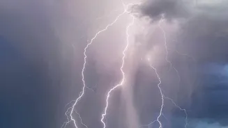
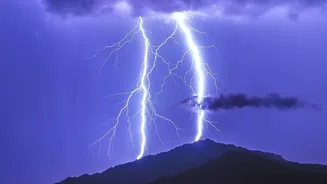
A fire that creates its own weather is a firefighter's nightmare because it becomes dangerously unpredictable. The pyrocumulonimbus doesn't just tower in the sky; it actively worsens the situation on the ground. The storm generates powerful and erratic winds that can change the fire's direction in an instant, spreading flames far beyond containment lines. Most dangerously, it can produce lightning. These lightning strikes can hit the dry ground far from the original fire front, igniting new blazes and exponentially complicating firefighting efforts. This creates a terrifying feedback loop where the fire spawns a storm, and the storm, in turn, fuels and spreads the fire.
A Sign of a Hotter Future?
While pyrocumulonimbus clouds are rare, they are becoming more common, particularly in places like Australia and North America which have seen an increase in extreme wildfire seasons. The fact that one has now been recorded for the first time in France is a sobering indicator of how climate change is intensifying weather extremes. Europe is the world's fastest-warming continent, and the extreme heat and dry conditions that allow these monster fires to thrive are becoming more frequent. While climate change doesn't directly create fire clouds, it creates the perfect conditions for the massive, high-intensity wildfires that are a prerequisite for their formation. The appearance of this fire-breathing storm over Europe is a stark visual confirmation of a new and more volatile fire regime.