



A Land on the Tectonic Edge
Japan’s seismic reality is a product of its precarious position. The archipelago sits atop the Pacific Ring of Fire, a hotbed of volcanic and earthquake activity. More specifically, it's at the convergence point of several major tectonic plates. Off its northeast
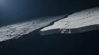
coast, in the Japan Trench, the massive Pacific Plate dives, or subducts, beneath the continental plate that carries Japan. To the south, in the Nankai Trough, the Philippine Sea Plate does the same. This constant, slow-motion collision accumulates immense stress along the plate boundaries. When that stress is released suddenly, the result is an earthquake, which can displace huge volumes of water and trigger devastating tsunamis.
The Deep-Sea Frontier
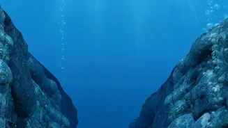
For decades, scientists believed that the largest, most dangerous ruptures happened deep within the Earth's crust. The shallow portions of the faults near the seafloor were thought to be too weak to cause major slips. The 2011 Tōhoku earthquake shattered that assumption. That magnitude 9.1 event saw the largest movement—a staggering 50 to 60 metres—occur right near the seabed of the Japan Trench. This shallow slip was the primary driver of the catastrophic tsunami that followed. This shocking discovery shifted the focus of global seismology. To truly understand these mega-quakes, scientists realised they had to go to the source: the dark, high-pressure environment of the offshore trenches themselves.
Drilling into the Danger Zone
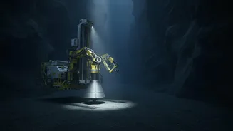
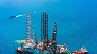
Enter the D/V Chikyu, the world's largest scientific drilling vessel. Operated by the Japan Agency for Marine-Earth Science and Technology (JAMSTEC), Chikyu is a floating state-of-the-art laboratory capable of drilling thousands of metres below the seafloor in some of the deepest waters on Earth. Through ambitious projects like the Japan Trench Fast Drilling Project (JFAST) and the Nankai Trough Seismogenic Zone Experiment (NanTroSEIZE), international teams of scientists have used Chikyu to do the seemingly impossible: drill directly into the active fault zones that generate these earthquakes. These expeditions collect invaluable core samples and install long-term observatories with sensors to measure temperature, pressure, and fluid flow deep within the fault.
What the Seafloor Reveals
The findings from these deep-sea missions have been revolutionary. Analysis of core samples from the Japan Trench revealed a critical clue about the 2011 quake: a thin, incredibly slippery layer of pelagic clay. Researchers confirmed this clay layer acted as a lubricant, allowing the fault to slip an immense distance with very little friction, which generated the massive tsunami. In addition to physical samples, scientists also measured the residual heat from the friction of the 2011 quake, confirming the fault's unusual weakness. Other research in the Nankai Trough has focused on identifying so-called "locked zones" where stress is building up, although recent studies show these zones can be more fluid than previously thought, complicating prediction efforts.
From Data to Defence
While the holy grail of accurately predicting the exact time and place of a major earthquake remains elusive, this deep-sea research is not just an academic exercise. The data gathered from the Japan Trench and Nankai Trough provides crucial insights into fault behaviour. This information is fed into more sophisticated models to better forecast the potential size and impact of earthquakes and, critically, the tsunamis they can generate. By understanding the physical properties of a fault and how it might rupture, authorities can create more accurate hazard maps and improve early warning systems. These borehole observatories provide real-time data on the subtle changes happening deep underground, offering a window into the living dynamics of a fault.