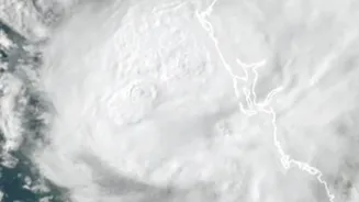








What Is Cyclone Akvan's Current Status?
As of November 18, the India Meteorological Department (IMD) has classified Akvan as a Severe Cyclonic Storm. It formed over the Bay of Bengal and has been slowly moving north-northwestwards. The storm's slow movement in its initial stages has created
some uncertainty among weather models regarding its exact track and peak intensity. However, it is expected to strengthen into a Very Severe Cyclonic Storm by November 19 before approaching the coast. The name 'Akvan' was contributed by Iran as part of the regional naming system for tropical cyclones.
Where Is It Expected to Make Landfall?
The IMD's forecast indicates that Cyclone Akvan is likely to make landfall around noon on Friday, November 20. While the exact point can shift, the projected path currently targets the coastline between Narsapur in Andhra Pradesh and Puri in Odisha. This is a northward revision from earlier forecasts which had the landfall zone further south. An Orange Message, which serves as a cyclone alert, has been issued for the coasts of Andhra Pradesh and the adjoining southern part of Odisha.
What Is the Expected Intensity and Impact?
Upon landfall, Akvan is predicted to be a Severe Cyclonic Storm with maximum sustained wind speeds of 90-110 kmph, gusting up to 120-145 kmph. Such winds are capable of causing significant damage to homes, uprooting trees, and disrupting power and communication lines. In addition to the fierce winds, the storm is expected to bring extremely heavy rainfall to coastal districts of Andhra Pradesh on November 19 and 20. Heavy to very heavy rainfall is also predicted for parts of Odisha, Telangana, and West Bengal as the system moves inland. The IMD has warned of phenomenal sea conditions, with waves potentially reaching over 14 metres in the storm's path, and has advised all fishermen to return to shore and avoid the sea.
How Are Authorities Preparing?
State governments in Andhra Pradesh and Odisha have activated their disaster response machinery. The National Disaster Response Force (NDRF) has deployed teams to vulnerable districts, with additional units on standby. District collectors have been instructed to identify and prepare cyclone and flood shelters, ensuring they have water, food, and power backups. Special attention is being given to evacuating people from low-lying coastal areas, kutcha houses, and regions prone to landslides. Departments overseeing power, communication, and water are on alert to ensure quick restoration of services post-cyclone.
How Can You Stay Safe?
If you are in the storm's projected path, it is crucial to stay informed through official channels like the IMD website and local news. Prepare an emergency kit with essentials like non-perishable food, drinking water, a first-aid kit, torches, and extra batteries. Secure your home by boarding up glass windows and moving loose objects like pots and furniture indoors. Charge your mobile phones and power banks. If authorities issue an evacuation order, do not hesitate. During the cyclone, stay indoors, switch off electrical mains and gas supplies, and avoid using any water from the tap until it is declared safe.