






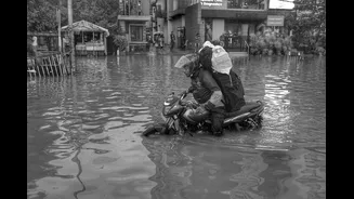
The Warning Paradox: High-Tech Alerts, Limited Reach
Kerala is no stranger to the monsoon’s fury. Following the catastrophic floods of 2018, the state has significantly upgraded its disaster management capabilities. The Kerala State Disaster Management Authority (KSDMA) now operates with a multi-layered
system, disseminating alerts from the India Meteorological Department (IMD) through colour-coded warnings like red and orange alerts. In early August 2026, intense rainfall again led to flash floods and landslides, claiming lives and forcing thousands into relief camps. Despite these advanced preparations and systems like the KaWaCHaM early warning network, designed for last-mile dissemination with sirens and public address systems, a critical question remains: why do these warnings not always translate into timely action on the ground? The technology exists, but the connection to the most at-risk populations often breaks down.
Defining Vulnerability: Beyond Geography
When we talk about 'vulnerable communities', it’s not just about who lives in a low-lying area or on a landslide-prone hill. Vulnerability is a complex mix of social, economic, and geographical factors. In Kerala, this includes coastal fishing communities who face the double threat of river flooding and sea-level rise. It includes tribal settlements in remote, hilly regions of districts like Idukki and Wayanad, where mobile networks are patchy and access roads can be washed away in an instant. Daily wage labourers, who cannot afford to miss a day of work based on a warning that might not materialize, are also at high risk. Furthermore, language barriers can be a significant hurdle for migrant workers, who may not understand alerts issued in Malayalam. These groups often lack the resources, information access, or social safety nets to act on a warning, even if they receive one.
The Last-Mile Problem: Why Messages Get Lost
The greatest challenge lies in the 'last mile' of communication. A state-wide alert is only effective if it prompts a family in a remote hamlet to move to safety. Several factors cause a breakdown. Firstly, there's the technology gap. While smartphone penetration is high, network connectivity in hilly or remote areas can be unreliable, especially during extreme weather. Secondly, the messaging itself can be problematic. A generic 'red alert' may not convey the specific, immediate action required. Is the threat from a river overflowing, a potential landslide, or a dam release? Without clear, actionable information, alerts can be perceived as noise. Finally, there is the crucial element of trust. If past warnings were perceived as false alarms, communities might become complacent. Effective communication relies on trusted local sources, not just top-down official broadcasts.
Bridging the Gap: People, Trust, and Technology
Experts and officials are increasingly recognising that the solution is not just more technology, but better integration of technology with community-led systems. This means moving towards a 'bottom-up' approach. Empowering local panchayats and community volunteer groups, who possess intimate knowledge of their locality, is critical. These groups can translate broad warnings into specific, local advice and physically ensure the message reaches every household. Integrating local knowledge with scientific monitoring is essential. Using a variety of communication channels is also key – from SMS blasts and social media to announcements via community radio, places of worship, and even door-to-door volunteers. The actions of fishermen who rescued thousands during the 2018 floods demonstrated the power of community social capital in a crisis. Formalising and supporting these local networks is a crucial step.