





The Paris Goal's True Meaning
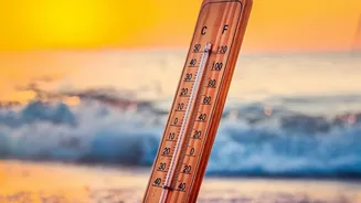
First, let's clarify what the Paris Agreement's 1.5°C target actually means. This crucial climate goal does not refer to a single day, month, or even a year when the global average temperature might spike. Instead, it refers to sustained warming over
a long period. Climate scientists at bodies like the Intergovernmental Panel on Climate Change (IPCC) measure this by averaging global temperatures over 20 to 30 years. This multi-decade average smooths out short-term ups and downs, giving a clear picture of the underlying, human-caused warming trend. So, when we talk about breaking the 1.5°C barrier in the context of the Paris accord, we mean that the 20- or 30-year average has permanently crossed that threshold, not just a temporary flirtation with it.
A Forecast vs. A Broken Promise
Recently, you may have seen alarming forecasts. Organizations like the World Meteorological Organization (WMO) have warned there is a very high probability—as much as an 80% to 90% chance—that at least one year in the next five will see its average temperature temporarily exceed 1.5°C above pre-industrial levels. While deeply concerning, the WMO and other scientific bodies are quick to point out that this does not mean the Paris goal has been officially missed. Think of it as a serious warning shot. These individual hot years are symptoms of a warming planet, but they are not the same as the long-term climatic shift the Paris Agreement was designed to prevent. The goal itself is about the persistent, decades-long temperature average.
Weather Noise vs. Climate Signal
This brings us to the fundamental difference between weather and climate. Weather describes atmospheric conditions over a short period—a hot day, a rainy week, or a stormy season. Climate, on the other hand, is the average of that weather over many years, even decades. An unusually warm year is a weather event, not a definitive change in the long-term climate. Natural phenomena are a major source of this short-term "noise." The most significant of these is the El Niño-Southern Oscillation (ENSO), a natural and cyclical climate pattern. During an El Niño phase, which occurs every two to seven years, vast amounts of heat from the tropical Pacific Ocean are released into the atmosphere, temporarily pushing global average temperatures higher. This natural boost rides on top of the steady upward trend of human-caused warming, leading to the record-breaking annual temperatures we are seeing forecast.
Why The Distinction Matters Now
Understanding this distinction is not just academic; it's critical for our response to climate change. Mistaking a temporary spike for a permanent breach of the Paris goal could lead to a sense of hopelessness, a feeling that the fight is already lost. But that isn't the case. While these individual hot years are a clear sign that the window for action is narrowing, they also serve to highlight the urgency of the situation. They are previews of what a permanently warmer world could feel like, driving home the reality of what’s at stake. Scientists see these spikes not as a finish line being crossed, but as a loud alarm bell ringing. The underlying long-term trend is what we can influence through sustained efforts to reduce greenhouse gas emissions. These efforts are aimed at bending the long-term curve downwards, even if natural cycles cause temporary bumps along the way.