





1. The 2023 Sikkim Glacial Flood
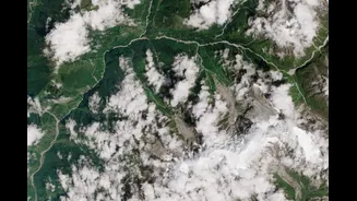
In October 2023, the South Lhonak glacial lake in Sikkim breached its moraine dam, unleashing a catastrophic flood. The disaster destroyed the Teesta-III hydropower dam and claimed dozens of lives. The warning sign was unmistakable and had been tracked
for years: satellite imagery showed the lake was one of the fastest-growing in the region. A 2021 study had specifically modeled the outburst risk for this very lake, effectively predicting the disaster two years before it happened. The event was ultimately triggered by a massive landslide into the lake, a possibility that experts say needs more attention in future hazard assessments.
2. The 2023 Joshimath Land Subsidence
In January 2023, the town of Joshimath in Uttarakhand began to visibly sink, with large cracks appearing in hundreds of homes and buildings. This was not a sudden event but the culmination of decades of warnings. The most significant was the 1976 Mishra Committee report, which declared that Joshimath was built on the debris of an ancient landslide and was unsuitable for major construction. The report explicitly warned against heavy construction and recommended proper drainage systems to prevent water seepage and soil erosion, advice that was largely ignored as the town expanded into a major hub for pilgrimage and tourism.
3. The 2021 Chamoli (Rishi Ganga) Flood
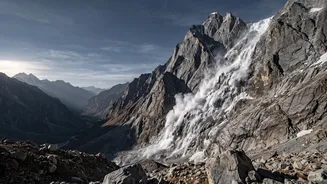
In February 2021, a devastating flash flood tore through the Rishi Ganga and Dhauliganga valleys in Chamoli, Uttarakhand, killing over 200 people and wiping out two hydropower projects. Initially mistaken for a glacial lake outburst, scientists later confirmed it was caused by a colossal rock and ice avalanche from Ronti Peak. The warning here was systemic: experts had previously advised against building hydropower projects in this specific, para-glacial zone, citing its known instability. The disaster underscored the immense risks of large-scale infrastructure development in high-mountain environments where monitoring for such hazards remains inadequate.
4. The 2013 Kedarnath Floods
One of India's deadliest natural disasters, the June 2013 floods in Uttarakhand killed more than 6,000 people. The catastrophe was caused by a combination of unusually heavy monsoon rains and the breach of Chorabari glacial lake. While the extreme rainfall was a major factor, the disaster's scale was magnified by man-made issues. The clear warning sign was the years of rampant, unregulated construction of hotels, shops, and roads directly on the floodplains and fragile slopes of the Mandakini river, which amplified the flood's destructive power when it came.
5. The 2015 Nepal Earthquake
The magnitude 7.8 Gorkha earthquake in April 2015 devastated central Nepal, killing nearly 9,000 people and causing widespread destruction. While predicting earthquakes is impossible, the primary warning was geological. Scientists had long identified this specific area as the 'Central Seismic Gap'—a region of the Himalayas where immense tectonic stress had been accumulating for centuries without a major release. The 2015 quake only partially ruptured this gap, and experts warn that significant strain remains, pointing to the potential for future large earthquakes in the region. The disaster also highlighted the known vulnerability of buildings that were not constructed to withstand seismic activity.
6. The 2010 Leh Flash Floods
In August 2010, the high-altitude desert region of Leh was struck by an unprecedented cloudburst that triggered devastating flash floods and mudflows, killing over 250 people. The area is known for being extremely arid, so the population was unprepared for such intense rainfall. The disaster served as a stark warning about how changing weather patterns and climate change can bring extreme events to regions that have not historically experienced them. The traditional mud-brick houses, perfectly suited for a dry climate, could not withstand the force of the water, highlighting a vulnerability that had not been previously considered a major threat.
7. The 1998 Malpa Landslide
In August 1998, an entire village, Malpa in Uttarakhand's Kali Valley, was wiped out by a massive landslide, killing 221 people, including 60 pilgrims. The disaster was triggered by heavy rains on geologically unstable terrain. The warning signs were the region's inherent fragility—steep, fractured slopes located in a seismically active zone. Reports following the event noted that the area's distressed geology, a result of the ongoing northward drift of the Indian plate, makes such slopes exceptionally vulnerable. It was a tragic lesson in the dangers of building and inhabiting areas prone to such catastrophic slope failures, especially during monsoon season.