





A New Eye on a Changing Planet
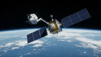
Launched in July 2025, NISAR is a groundbreaking Earth observation mission jointly developed by the Indian Space Research Organisation (ISRO) and the U.S. National Aeronautics and Space Administration (NASA). It stands as one of the most sophisticated
and expensive Earth-imaging satellites ever built. Unlike optical satellites that rely on sunlight and clear skies, NISAR uses advanced dual-frequency synthetic aperture radar (SAR). This technology allows it to peer through clouds and darkness, providing an uninterrupted stream of data on the planet's surface changes. Its primary goal is to make global measurements of the causes and consequences of land surface changes, including ice sheet collapse, ecosystem disturbances, and natural hazards like earthquakes. By scanning nearly all of Earth's land and ice-covered surfaces twice every 12 days, NISAR generates an unprecedented volume of information, helping scientists monitor the planet's pulse with remarkable precision.
Journey to a Lonely Peak
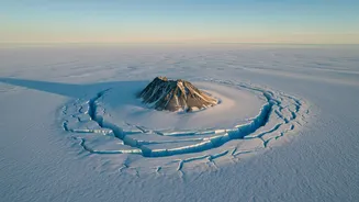
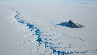
The focus of this remarkable new imagery is Nunatak Zaterjavshijsja, a rocky mountaintop in East Antarctica. The word "nunatak" comes from the Greenlandic Inuit language, meaning "lonely peak." It describes a geographical feature where a mountain summit protrudes through a surrounding glacier or ice sheet, appearing like an island in a sea of ice. These lonely peaks are invaluable to scientists. They serve as fixed reference points in otherwise moving landscapes, helping researchers understand glacier flow and historical ice thickness. As the ice moves around them, it is stretched and stressed, much like water flowing around a boulder in a river. Nunatak Zaterjavshijsja provides a perfect natural laboratory for observing these powerful dynamics in one of Earth's most inaccessible regions.
Reading the Glacier's Scars
The recent data from NISAR has produced a visually striking image that scientists have nicknamed "the hummingbird." The dark body of the 'bird' is the nunatak itself, while the 'plumage' is an intricate pattern of crevasses—deep cracks and fractures in the ice. These cracks are not random; they are stress lines that reveal how the massive ice sheet is deforming as it flows around the unmoving mountain. NISAR's L-band radar can penetrate snow and see into the ice, mapping these features in three dimensions. The image was created using a technique that assigns different colors based on the orientation of the reflected radar waves. Smooth, regular ice surfaces appear magenta, while the complex, fractured faces of the crevasses show up as sharp green lines, providing a clear map of the glacier's internal stress.
Why This Picture Matters
Beyond its aesthetic appeal, this detailed mapping of glacier movement is critical for climate science. Glaciers and ice sheets are not static; they are slow-moving rivers of ice, and their speed is a key indicator of climate change. Tracking how fast they move, where they accelerate, and how they fracture is essential for accurately predicting their contribution to global sea-level rise. The detailed crevasse patterns around Nunatak Zaterjavshijsja provide direct physical evidence of the ice's dynamics and stability. By using SAR technology to monitor these changes with centimeter-level precision over time, missions like NISAR give scientists the data needed to refine models of ice loss and improve forecasts for our planet's future. It's a vital tool for understanding the health of Earth's polar regions and the far-reaching consequences of their changes.