





Hellas and Argyre: Nature's Giant Laboratories
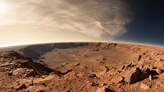
The focus of the PRL study was not just any part of Mars, but two of its most significant features: the Hellas and Argyre impact basins. These aren't just craters; they are colossal structures that profoundly influence the Martian climate. Hellas Planitia
is the largest visible impact basin on the planet, stretching over 2,000 kilometres and plunging more than seven kilometres deep. This extreme depth means the atmospheric pressure at its floor is significantly higher than on the rest of the planet—high enough, in fact, that under the right conditions, liquid water could theoretically exist without immediately boiling away. Argyre, while smaller, is another massive ancient impact site that provides a crucial point of comparison. By studying these two natural laboratories, scientists can gain unparalleled insights into how geography, elevation, and a thin atmosphere interact to create Mars's complex weather systems.
Decoding Mars's Turbulent Weather
The study, published in the journal Current Science, paints a picture of a planet with extreme temperature variations. Researchers found that surface temperatures can swing wildly from a relatively balmy 22-27°C during a summer day to a bone-chilling -123°C in winter. These massive fluctuations are largely due to Mars's thin atmosphere, which is about 100 times less dense than Earth's and can't effectively trap and distribute solar heat. The planet's elliptical orbit also plays a major role, making southern summers particularly intense. But the PRL team discovered more than just seasonal changes. They identified large, wave-like temperature patterns that ripple across the basins, revealing how the planet's atmospheric circulation works. Hellas, for example, showed more complex wave patterns than Argyre, likely due to its immense size and unique topography, confirming just how much the Martian landscape shapes its climate.
The Technology Behind the Breakthrough
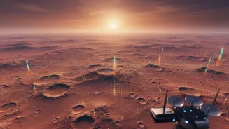
To create these detailed temperature maps, the Ahmedabad-based scientists utilized a wealth of data from an international partner: the United Arab Emirates' Hope spacecraft. Specifically, they analysed observations from the Emirates Mars Infrared Spectrometer (EMIRS), a sophisticated instrument designed to measure infrared radiation—or heat—emanating from the Martian surface and lower atmosphere. The Hope mission is particularly well-suited for this kind of climate study because its unique, high-altitude orbit allows it to observe the planet globally across different times of the Martian day. This provides a complete picture of diurnal (daily) temperature cycles that missions in lower orbits cannot capture. By meticulously processing this data, the PRL scientists were able to create the most comprehensive thermal picture of these regions to date.
Paving the Way for Future Missions
This research is far more than just a weather report for another world. Detailed climate models are critical for the success of future robotic and human missions to Mars. Understanding temperature extremes is vital for designing rovers and habitats that can withstand the harsh environment. For instance, knowing the precise daily and seasonal temperature swings helps engineers protect sensitive electronics and plan power usage, especially for solar-powered vehicles. Furthermore, these temperature maps provide crucial context in the ongoing search for water ice. Buried glaciers of water ice are believed to exist in regions like Hellas, protected from sublimation by layers of dust and rock. By understanding the surface temperature, scientists can better predict where ice might be stable just beneath the surface. This work by the Physical Research Laboratory directly supports future exploration, including potential Indian-led missions to the Red Planet.