








Anatomy of a Deluge
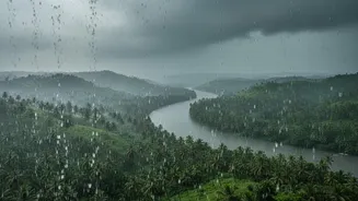
On August 1, 2026, the sky opened up over Kerala. The Ayyankunnu area in Kannur district recorded a staggering 320mm of rainfall, while other areas saw similar cloudburst-like conditions. To put that into perspective, it's an overwhelming amount of water
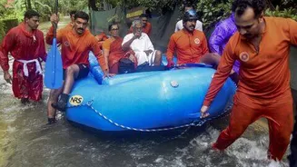
in a very short period, turning streets into rivers and causing water to surge into homes and businesses. The immediate aftermath was devastating, with multiple fatalities, missing persons, and thousands displaced into relief camps across several districts, including Idukki, Pathanamthitta, and Kottayam. This event wasn't just heavy rain; it was a shock to the system, overwhelming natural and man-made drainage in a matter of hours.
The New Face of a Monsoon
This torrential downpour is not an isolated freak event but a symptom of a disturbing new pattern. Scientists have observed that rainfall in Kerala is becoming more concentrated and intense. Instead of prolonged, steady showers, the monsoon now often delivers its payload in short, brutal bursts. Studies show that human-caused climate change is supercharging the monsoon, making extreme rainfall events more frequent and heavier. One analysis found that warming has made these downpours about 10% more intense. After a relatively dry June and July, which saw a rainfall deficit, this sudden deluge demonstrates a climate shift towards more erratic and dangerous weather patterns.
A Landscape Under Pressure
Climate change is only part of the equation. Decades of human activity have fundamentally altered Kerala's landscape, stripping away its natural defences against floods. Unregulated quarrying, deforestation, and construction on fragile slopes have destabilised the Western Ghats, leading to more frequent landslides during heavy rain. Furthermore, rapid urbanisation has replaced absorbent paddy fields and wetlands with concrete and asphalt. These impervious surfaces prevent rainwater from seeping into the ground, forcing it to run off quickly into rivers that are already struggling to cope. This rapid funnelling of water is a key reason why flash floods now engulf towns so quickly.
Clogged Arteries, Choked Rivers
Kerala's rivers and reservoirs, the state's primary drainage arteries, are themselves compromised. Many rivers have lost significant water-carrying capacity due to years of silt and sand accumulation, a problem made worse by sediment deposited during the catastrophic 2018 floods. When a massive volume of water rushes down from the hills, these choked rivers can't handle the flow, causing them to breach their banks and inundate surrounding floodplains. Similarly, major reservoirs have also seen their storage capacity reduced by sedimentation. This means that during an extreme rainfall event, authorities face difficult choices about releasing water from dams, which can sometimes aggravate downstream flooding if not perfectly coordinated.
Echoes of 2018 and an Urgent Future
The events of August 2026 are a painful reminder of the devastating 2018 floods, which served as a wake-up call for the state. While Kerala has since made significant strides in improving early warning systems and disaster response, this latest deluge shows that reactive measures alone are not enough. Experts argue that unless the root causes—ecological degradation and unsustainable land use—are addressed, the state will remain locked in a cycle of disaster and recovery. The 320mm downpour is not just a weather report; it is a clear and urgent message that building resilience must go deeper than just preparing for the next flood. It requires rethinking how the state develops and manages its precious, and increasingly fragile, landscape.