








A Tale of Two Sciences
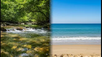
On one side, you have hydrology, the study of water on and beneath the Earth's land surfaces. Hydrologists track rivers, measure groundwater levels, and analyze soil moisture. On the other, oceanographers study the currents, salinity, and temperature
of the sea. Both fields are essential, but they often operate in silos, using different methods, data formats, and terminologies. It’s like trying to assemble a complete picture puzzle when half the pieces are in a different language and designed for a different puzzle altogether. This fragmentation isn't just an academic quirk; it represents a major barrier to understanding the complete water cycle, which seamlessly links atmospheric moisture, rainfall over land, river discharge into the ocean, and evaporation from the sea surface.
The Real-World Cost of Silos
This lack of integration has profound real-world consequences. When land and ocean data don't speak the same language, our ability to forecast and manage critical events is hampered. For instance, accurately predicting the impact of a major flood requires understanding not just the rainfall and river flow (hydrology), but also the coastal sea level and tidal conditions (oceanography) that can prevent floodwaters from draining away. Similarly, managing a nation's water resources—a pressing issue in India—demands a holistic view. Without unified data, it's harder to model how changes in land use affect river runoff, which in turn impacts the salinity and health of coastal estuaries vital for fisheries. Scientific bodies have noted for years that until recently, international exchange standards for hydrological data were the exception, not the rule, making large-scale analysis difficult.
The Power of a Common Language
The solution lies in creating and adopting common standards. This doesn't mean forcing every scientist to use the exact same tool, but rather establishing a shared framework for data and metadata—the 'data about the data'. Initiatives like the World Meteorological Organization's 'WaterML2' and the International Hydrographic Organization's 'S-100' framework are steps in this direction. These standards create a universal translator, allowing data from a river gauge in the Himalayas to be seamlessly integrated with data from a salinity sensor in the Bay of Bengal. Adopting such standards allows for the creation of powerful 'big data' models that see the Earth's water system as a whole. This integrated approach can improve everything from climate change projections to the management of local water supplies and the prediction of harmful algal blooms.
Building the Bridge for a Connected Future
Several organizations are working to build this bridge. The U.S. Integrated Ocean Observing System (IOOS), for example, requires its partners to manage data according to federal standards to ensure reliability and interoperability. The goal is to make data 'FAIR'—Findable, Accessible, Interoperable, and Reusable. This allows satellite data on evapotranspiration (water used by plants) to be combined with groundwater measurements to give farmers and water managers a complete picture of water consumption. By treating the entire hydrological cycle as a single, interconnected object of study, scientists can unlock new insights and provide clearer, more actionable information to policymakers and the public. The challenge is not just technical but also cultural, requiring collaboration across disciplines that have long operated independently.