








An Unblinking Eye in the Sky
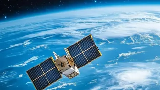
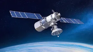
For decades, high-resolution satellite imagery was the exclusive domain of powerful governments. Today, the space industry has been commercialized. Companies like Planet Labs, Maxar, and others have launched vast constellations of small satellites, creating
an unprecedented firehose of data about the planet. Instead of waiting days or weeks for a single image of a location, users can now get multiple high-resolution snapshots per day. This has democratized access to what is known as geospatial intelligence (GEOINT). The technology is not limited to simple photographs; Synthetic Aperture Radar (SAR) satellites can see through clouds and at night, providing an all-weather, 24/7 monitoring capability. This surge in privately collected data is fueling a multi-billion dollar market for Earth observation services, serving clients from agriculture and urban planning to insurance and hedge funds.
AI as the Ultimate Analyst
The sheer volume of data—measured in petabytes—is far too large for human analysts to process manually. This is where artificial intelligence becomes a transformative partner. AI, and specifically computer vision, automates the analysis of satellite imagery at a scale and speed previously unimaginable. Algorithms can now perform object detection to count cars in a parking lot to gauge economic activity, track the movement of ships to monitor supply chains, or identify illegal logging operations in dense forests. More advanced models go beyond simple identification, using machine learning to detect subtle changes over time, forecast crop yields, or even provide early warnings for natural disasters like floods and wildfires by analyzing atmospheric and land data. Some satellites are even beginning to use onboard AI to process data directly in space, reducing the time from observation to actionable insight.
What the Evidence Shows: A Force for Good
The tangible benefits of this technological convergence are well-documented. For humanitarian efforts, AI-powered analysis of satellite data is critical for disaster response, allowing responders to quickly map damage, identify accessible routes, and locate stranded populations. In environmental science, these tools provide objective, verifiable data on deforestation, greenhouse gas emissions, and the impacts of climate change, holding both corporations and governments accountable for their environmental commitments. Journalists and human rights organizations have used commercial satellite imagery to expose military buildups before conflicts and to document atrocities in war zones, providing a level of transparency that was once impossible. This capability allows for independent verification of events on the ground, serving as a powerful check on disinformation.
The Unwritten Rulebook and Dual-Use Dilemma
While the benefits are clear, the evidence also points to significant governance gaps. The core problem is the dual-use nature of the technology: a satellite image used to monitor crops can also be used for military targeting. This ambiguity puts commercial satellite companies in a precarious legal and ethical position. International law, including the Outer Space Treaty, was written when space was the domain of states, not private companies, and it lacks clear rules for these new actors. This creates several risks. Belligerents in a conflict may view a commercial satellite providing imagery to their adversary as a legitimate military target, raising the risk of escalation. There are also pressing questions about data sovereignty and privacy. As image resolution improves, the ability to monitor private property or individual activity grows, but the legal frameworks to protect citizens from this type of surveillance are lagging. Furthermore, governments have been known to request that companies restrict access to imagery over conflict zones, highlighting the tension between transparency and national security.