




How a Landslide Creates a Lake
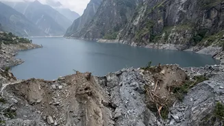
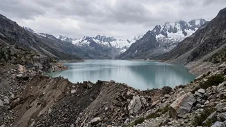
A barrier lake, also known as a landslide dam, is a natural phenomenon that occurs when a large amount of debris—such as rock, soil, and ice—slides down a mountainside and blocks a river's flow. This natural dam causes water to accumulate upstream, forming
a lake. While the initial landslide is a disaster in itself, the formation of the lake creates a secondary, and often more unpredictable, threat. The debris wall is typically unstable, lacking the engineered strength of a man-made dam. It can fail suddenly due to the immense pressure of the water building up behind it, erosion, or further geological activity.
The Current Threat on the Nepal Border
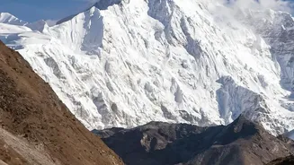
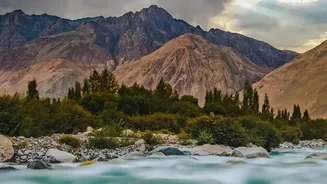
Recent events in the Himalayas have created just such a scenario. A catastrophic glacier collapse and landslide event around August 26, 2026, unleashed a devastating flood along the Nepal-Tibet border. In the aftermath, the debris blocked key river channels, including tributaries that flow into India. Chinese and Nepalese authorities identified a significant barrier lake that formed near the confluence of the Chhochen Khola and Purepu Tsangpo rivers. This new lake quickly swelled, holding millions of cubic metres of water and raising fears of a sudden breach that could trigger a second wave of catastrophic flooding.
Indian States on High Alert
The rivers at the heart of this crisis, particularly the Bhote Koshi and Trishuli, are part of the larger Gandak river basin, which flows from Nepal into India. Consequently, authorities in the downstream states of Bihar and Uttar Pradesh have been placed on high alert. Districts such as Maharajganj and Kushinagar in Uttar Pradesh, along with areas in West Champaran in Bihar, are particularly vulnerable. Officials have been continuously monitoring water levels at key points like the Gandak Barrage, where all 36 gates were opened to manage the flow and mitigate the impact of any potential surge from upstream. Evacuation plans have been activated in low-lying villages as a precautionary measure.
The Official Coordinated Response
Both Nepalese and Indian disaster management authorities are closely monitoring the situation. India's National Disaster Management Authority (NDMA) has been in constant communication with its counterparts in Nepal. While the initial threat from the lake was high, reports by August 30 suggested that the barrier had partially breached and was draining in a more controlled manner, averting the worst-case scenario of a total collapse for now. However, the situation remains volatile. India has positioned National Disaster Response Force (NDRF) teams in vulnerable districts and reiterated its role as a first responder to assist Nepal. Early warning systems, which involve sharing real-time hydrological data between the two countries, are crucial in providing lead time for evacuations.
A Reminder of Past Disasters
For residents of Bihar, this threat is a grim reminder of past tragedies, most notably the 2008 Kosi embankment breach in Nepal. That event diverted the entire flow of the Kosi river into a new channel, leading to devastating floods that affected millions in northern Bihar. The current crisis underscores the transboundary nature of Himalayan climate risks. Experts note that rising global temperatures are making the Himalayan region more unstable, leading to more frequent glacier melts, landslides, and the formation of dangerous glacial and barrier lakes. These cascading events highlight the urgent need for enhanced cross-border cooperation on disaster preparedness and early warning systems to protect vulnerable downstream communities.