





A New Sentinel in the Sky
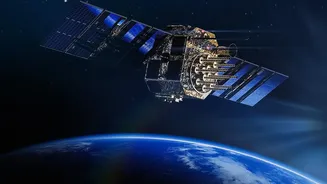
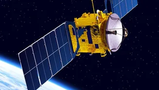
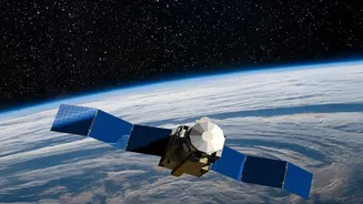
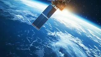
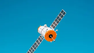
The star of the show is India's newest geo-imaging satellite, a powerful 'eye in the sky' designed for high-altitude observation. Placed in a geostationary orbit around 36,000 km above the Earth, it will match the planet's rotation, allowing it to continuously
monitor the Indian subcontinent. This constant watch is a game-changer compared to satellites in lower orbits that pass over a location only a few times a day. While ISRO has a robust constellation of remote sensing satellites, this mission provides a unique, persistent gaze that enhances India's observation capabilities for strategic and civilian purposes alike.
The 'Bahubali' of Rockets
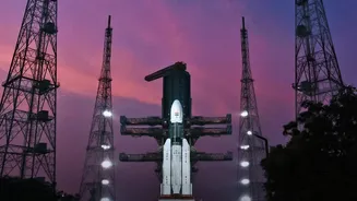
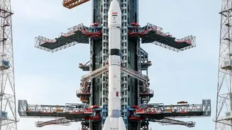
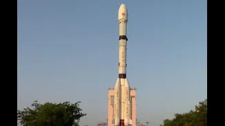
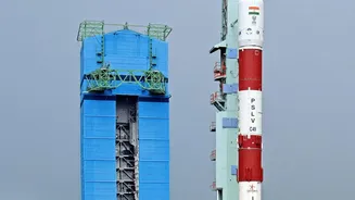
Getting a heavy satellite to such a high orbit is no small feat. This is where ISRO's most powerful rocket, the LVM3 (Launch Vehicle Mark-III), comes in. Often nicknamed 'Bahubali' for its impressive size and strength, the LVM3 stands 43.5 metres tall and has a lift-off mass of 640 tonnes. It is a three-stage vehicle featuring two massive S200 solid rocket boosters, a liquid-fueled core stage, and a crucial indigenous C25 cryogenic upper stage. The LVM3's ability to launch payloads of up to 4,000 kg to Geostationary Transfer Orbit (GTO) is vital for India's self-reliance in space. Previously, India had to depend on foreign launch providers for its heavier satellites. With the LVM3, ISRO can launch its most ambitious missions, including communication satellites and even the upcoming Gaganyaan human spaceflight, right from Indian soil.
What Exactly is an Earth-Observation Satellite?
Think of an Earth-observation (EO) satellite as a highly advanced camera and sensor platform in space. Its job is to collect data and imagery of our planet's surface, oceans, and atmosphere. The Indian Remote Sensing (IRS) satellite program, which began in 1988, has consistently provided crucial data for the nation. These satellites operate across different parts of the electromagnetic spectrum, allowing them to 'see' things the human eye cannot, such as heat signatures, vegetation health, and mineral deposits. The data gathered is invaluable for a wide range of applications that directly impact the lives of ordinary citizens.
From Space to the Common Man
The benefits of this high-tech mission will be felt on the ground across India. One of the most critical applications is disaster management. The satellite will provide near real-time imaging of large areas, enabling authorities to monitor the progress of cyclones, floods, and forest fires and to better coordinate relief efforts. In agriculture, EO data helps in forecasting crop yields, monitoring drought conditions, and assessing soil health, empowering farmers with crucial information. Furthermore, these 'eyes in the sky' support urban planning, monitoring water resources, exploring for minerals, and enhancing national security by keeping a watch over India’s vast land and maritime borders.
A Stepping Stone to Bigger Dreams
This successful launch is more than just a single achievement; it is a crucial building block for ISRO's future ambitions. Every successful flight of the LVM3 rocket builds confidence and provides valuable data for its most prestigious upcoming mission: Gaganyaan, India's first crewed spaceflight. A human-rated version of the LVM3 will be used to carry Indian astronauts into orbit. This launch also reinforces India's growing stature in the global commercial launch market, demonstrating its capability to handle complex and heavy payloads for other nations. It signals that ISRO is not only meeting its current goals but is also paving a clear path toward even greater accomplishments, such as a future Indian space station and sending an Indian to the Moon.