








First, What Is El Niño?
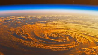
El Niño is a naturally occurring climate pattern, not a storm. It is defined by the unusual warming of sea surface temperatures in the central and eastern equatorial Pacific Ocean. This warming happens every two to seven years and can last for nine to twelve
months or more. This shift in ocean heat disrupts the atmosphere above it, altering large-scale wind and pressure patterns across the globe. The opposite of El Niño is La Niña, a cooling phase in the same region, while periods in between are considered neutral. Think of it as a massive redistribution of heat in the planet's largest ocean, with powerful ripple effects on weather worldwide.
How Does the Pacific Ocean Affect India's Monsoon?
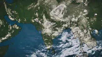
The Indian monsoon is a complex system driven by temperature and pressure differences between the land and the sea. El Niño disrupts this delicate balance. The warming of the Pacific weakens the crucial trade winds, which are connected to the moisture-carrying monsoon winds that blow towards India. This disruption can suppress the formation of clouds and reduce rainfall over the Indian subcontinent. Historically, there is a strong link between El Niño years and weaker monsoon rains, with at least half of all El Niño years resulting in monsoon droughts. However, the connection isn't a perfect one-to-one guarantee. Some El Niño years, like 1997, saw normal monsoons in India, proving that other climate factors can sometimes play a counteracting role.
The 2026 Outlook: What Forecasters Are Saying
As of August 2026, climate models are indicating that the developing El Niño is not just strong, but on track to be potentially one of the most intense ever recorded. The World Meteorological Organization (WMO) has stated that El Niño will continue to steadily intensify into a strong event through the August-October season. Forecasts suggest that sea surface temperature anomalies could exceed 2.9 degrees Celsius above average, which is a significant deviation. Some models project a peak warming of over 4 degrees Celsius above average by December, surpassing previous record-breaking events like the one in 2015. The India Meteorological Department (IMD) has forecast below-normal rainfall for the second half of the monsoon season, citing the strengthening El Niño conditions as a primary driver.
What a Weak Monsoon Means for India
The stakes for India are immense. The southwest monsoon delivers about 70-75% of the country's annual rainfall, and a significant portion of its agriculture is rain-fed. A weak monsoon directly threatens agricultural output, which can lead to lower farm incomes and reduced rural demand for goods like tractors and two-wheelers. This can create a significant drag on the economy. For urban and rural households alike, the most immediate impact is often felt through rising food prices. Lower production of essential crops like rice, pulses, and vegetables can lead to supply shortages and fuel inflation.
Beyond the Farm: Water and Energy Concerns
The impact of a poor monsoon extends far beyond agriculture. It is crucial for replenishing water resources in reservoirs across the country, which supply drinking water to countless cities and towns. Lower reservoir levels also impact hydroelectric power generation, potentially straining the energy grid. While forecasters are also watching for a potentially positive Indian Ocean Dipole (IOD)—a separate climate pattern that can sometimes counteract El Niño's drying effect on India—the current consensus is that the powerful El Niño will be the dominant force this year. As a result, the situation poses a serious risk to India's water and energy security.