




A Deluge from a Clear Sky
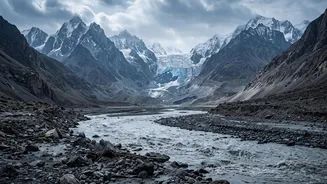
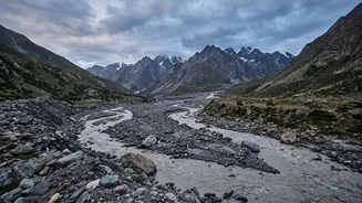
On February 7, 2021, residents and workers along the Rishiganga and Dhauliganga rivers in Uttarakhand’s Chamoli district were engulfed by a sudden, violent flood. The torrent arrived without the usual warning signs of heavy rain or an earthquake, carrying
with it a devastating slurry of sediment and large boulders that obliterated everything in its path. Two major hydropower projects, Rishiganga and Tapovan-Vishnugad, were severely damaged or destroyed, and tragically, over 200 people were killed or went missing, most of them workers at these sites. Initial speculation pointed to a glacial lake outburst flood (GLOF), a known hazard in the region. But satellite imagery soon revealed there were no significant glacial lakes upstream, deepening the mystery of the disaster's origin.
Anatomy of a Rock-Ice Avalanche
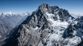
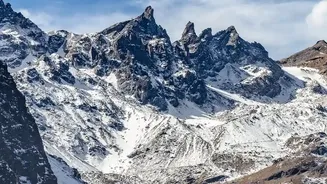
A global coalition of scientists pieced together the evidence using satellite data, seismic records, and eyewitness videos. They concluded the catastrophe was caused by a massive rock and ice avalanche. A gigantic wedge of rock, estimated at 27 million cubic meters and mixed with glacier ice, broke off the steep northern face of Ronti Peak from an altitude of over 5,500 metres. The sheer force of this collapse, a vertical drop of over three kilometres, generated immense frictional heat. This energy was enough to melt most of the ice within the falling mass almost instantly. The result wasn't just a landslide; it was a rapid transformation into a highly mobile, incredibly destructive debris flow — a dense, fast-moving mixture of water, mud, and rock that behaved like wet concrete and scoured the valley for kilometres.
The Climate Change Connection
While such geological failures are a natural part of mountain erosion, scientists stress that climate change is a critical, destabilising factor. The Himalayas are warming at a rate faster than the global average. This sustained warming is causing permafrost — the permanently frozen soil and rock that acts as a 'cement' holding steep slopes together — to thaw and weaken. As this natural binding agent degrades, the bedrock becomes less stable, dramatically increasing the likelihood of large-scale slope failures. Furthermore, warmer temperatures mean more precipitation falls as rain instead of snow at high altitudes, further destabilising the ground. The Chamoli event is seen as a stark example of this new and growing threat, where warming conditions prime the landscape for disaster.
Development in a Fragile Zone
The tragedy also cast a harsh spotlight on the dangers of aggressive infrastructure development in the geologically active and ecologically fragile Himalayas. Experts have long warned that extensive tunnelling, road construction, and the building of large hydropower dams can destabilise slopes and compound the risks of natural hazards. In the Chamoli disaster, the hydropower projects were not the cause of the collapse, but their location in the direct path of such a foreseeable, if rare, event amplified the human and economic cost immensely. The incident serves as a painful reminder of the tension between the region's energy needs and the imperative to respect the immense and often unpredictable power of its mountain environment.
An Uncertain Future
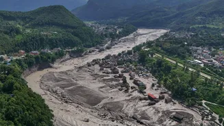
The Chamoli collapse was a wake-up call, demonstrating that Himalayan hazards are evolving. Rock-ice avalanches are harder to predict than GLOFs, as they often originate from non-glaciated, steep rock faces that are difficult to monitor. Recent, similar events in other parts of the Himalayas, such as Nepal, confirm that this is not an isolated phenomenon but an emerging and deadly threat. Protecting the millions of people who live downstream will require a fundamental shift in approach. This includes investing in better scientific monitoring of high-altitude slopes, developing robust early-warning systems, and, crucially, re-evaluating development models to ensure they are resilient to the growing and changing risks of life in the shadow of the world’s highest mountains.