
The Unsolvable Puzzle of Indian Roads
For decades, computer vision systems designed in the West struggled with Indian traffic. Their algorithms were trained on orderly roads with clear lane markings, predictable vehicle types, and drivers who generally follow the rules. These systems were built
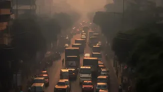
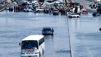
for a world of cars, trucks, and cyclists. They were not prepared for the sheer variety and unpredictdictability of an Indian street, which can feature everything from auto-rickshaws and handcarts to stray cattle sharing the same space. The term 'mixed traffic' in India represents a level of complexity that standard AI models simply couldn't process, making our roads one of the hardest computer vision problems on Earth.
Teaching AI to See in India
The breakthrough came from a simple idea: if you want an AI to understand Indian roads, you have to teach it with data from Indian roads. Researchers and tech firms began creating massive datasets specifically capturing our unique traffic conditions. Projects led by institutions like IIIT-Hyderabad developed the Indian Driving Dataset (IDD), a collection of thousands of images and videos from cities like Hyderabad and Bengaluru. This data is meticulously annotated, teaching the AI to distinguish between a car, a bus, a three-wheeler, and a motorcycle, even when they are tightly packed or partially obscured. This India-specific training is the secret sauce that allows the camera systems to finally make sense of the chaos.
From Watching to Understanding
Modern camera-based systems do more than just detect vehicles; they analyze behavior. Using advanced AI, they can identify traffic violations like riding without a helmet, triple riding, wrong-side driving, and jumping red lights. Initiatives like Project iRASTE (Intelligent Solutions for Road Safety through Technology and Engineering), launched in cities like Nagpur and across Telangana, use this technology to move beyond simple enforcement. The cameras are installed in public buses and at key junctions, feeding data to a central system. This system uses predictive analytics to identify risky driving patterns and potential collision scenarios, sending real-time alerts to drivers to prevent accidents before they happen.
Identifying Dangers Before They Become Tragedies
One of the most powerful applications of this technology is the identification of 'greyspots'. A blackspot is a location where multiple fatal accidents have already occurred. A greyspot, identified by AI, is a location that shows the warning signs of becoming a blackspot. By analyzing data on near-misses, sudden braking, and sharp swerves collected from camera-equipped vehicles, the system can flag stretches of road that are dangerous by design. This allows city planners and engineers to intervene proactively, fixing poor road design, adding signage, or improving lighting before a tragedy occurs. In Telangana, the iRASTE project has already identified over 60 such greyspots on highways using data from state transport buses.
The Road Ahead for Smart Traffic
The implementation of these systems is rapidly expanding. What started as pilot projects in Nagpur and Telangana is now being explored by other states. In Bengaluru and Delhi, AI-enabled cameras are already being used for automated challan generation, aiming to improve rule compliance through consistent, contactless enforcement. The results are promising. A pilot program involving 200 state buses in Telangana saw a 40% reduction in accidents for buses equipped with the AI-powered Advanced Driver Assistance Systems (ADAS) compared to those without. While challenges around cost, data privacy, and nationwide scalability remain, this technology represents a fundamental shift from reactive to proactive road safety management, paving the way for smarter, safer Indian cities.