







An Eye in the Sky for Water
For decades, managing a reservoir relied on ground-based gauges and historical records. While effective, this approach provides a limited snapshot. Today, a fleet of Earth-observing satellites offers a continuous, bird's-eye view. Missions like the joint
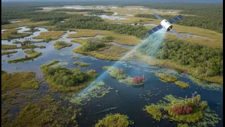
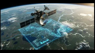
NASA and French space agency CNES Surface Water and Ocean Topography (SWOT) satellite are designed to conduct the first-ever global surveys of Earth's surface water. These satellites are equipped with advanced instruments like radar altimeters, which measure the precise height of the water's surface by bouncing signals back and forth. At the same time, other satellites like the Sentinel and Landsat series use multispectral imagers to capture the water's surface area, almost like taking a highly detailed photograph. By combining the height from one satellite with the area from another, managers can calculate something crucial: the total volume of water in a reservoir, and how it changes over time.
From Pixels to Practical Insights
Raw satellite data is just the beginning. The real magic happens when this information is processed into actionable insights. For example, by analysing the colour of the water, sensors can detect increases in sediment, which signals erosion, or chlorophyll-a, a key indicator of algal blooms that can affect water quality. Projects like OpenET use satellite data from sources like NASA and the US Geological Survey to calculate evapotranspiration—the amount of water consumed by crops and evaporated from the soil. This is a game-changer for agricultural planning, allowing for more precise irrigation. Studies focused specifically on Indian reservoirs have shown that data from satellites like Jason-3 and the Indo-French SARAL/AltiKa mission correlate strongly with on-ground gauge readings, proving their reliability for monitoring the country's critical water stores.
A Powerful Tool for Tough Decisions
The benefits of this technology are immense. With near real-time data, authorities can make faster and more informed decisions. During the devastating 2018 floods in Kerala, the limitations of ground-only monitoring became clear, highlighting the need for a system that could provide a wider view of potential inflows into dams. Satellite monitoring offers exactly that, providing a basin-wide perspective that is impossible to achieve from the ground alone. This capability is invaluable not only for flood prediction but also for drought management. By tracking declining reservoir levels across an entire region, governments can anticipate shortages and implement conservation measures more proactively. Furthermore, this data can be made accessible to the public, creating a transparent system for communicating water risks and needs.
Why Humans Remain in the Loop
Despite its power, satellite data is not a silver bullet that can replace human expertise. The headline's promise that it won't make decisions alone is a critical part of the story. For one, most optical satellites can only see the surface of the water; what happens in the depths, such as deep algal blooms, remains invisible. In the turbid, complex waters of many inland reservoirs, algorithms can struggle to distinguish between sediment, algae, and other organic matter. Furthermore, the resolution of some satellites is too coarse for India’s smaller rivers and reservoirs, a significant limitation in a landscape dotted with countless water bodies. For these reasons, satellite data must be constantly calibrated and validated with physical, on-the-ground measurements to ensure its accuracy. This process of 'ground-truthing' is where local knowledge and fieldwork remain indispensable.