






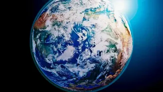

An Ocean Running a Fever
The Pacific Ocean is currently experiencing a significant marine heatwave. According to the latest updates from climate monitoring agencies in August 2026, sea surface temperatures in the central and eastern equatorial Pacific are substantially warmer
than average. The World Meteorological Organization (WMO) has noted that these temperature anomalies are expected to exceed 2.9°C above normal in key regions, fed by a massive reservoir of warm water in the ocean's subsurface. This rapid and intense warming is a textbook sign that a major climate event is not just developing, but actively intensifying. This phenomenon is the primary driver behind the formation and strengthening of an El Niño.
The El Niño Connection Explained
El Niño is one phase of a natural cycle called the El Niño-Southern Oscillation (ENSO). This cycle irregularly alternates every two to seven years between a warm phase (El Niño), a cool phase (La Niña), and neutral conditions. During an El Niño, the typical easterly trade winds that blow from the Americas towards Asia weaken. This allows the massive pool of warm water normally found in the western Pacific to surge eastward, toward the coast of South America. This shift in ocean heat is so significant that it alters atmospheric pressure and disrupts global wind and rainfall patterns, creating a cascade of effects felt across continents.
A 'Super El Niño' in the Making?
Scientists are concerned that this is not just a standard El Niño. The pace and intensity of the warming have led to forecasts of a “strong” or even “super” El Niño event developing through the end of 2026. A super El Niño is generally defined as an event where sea surface temperatures in key Pacific regions rise by 2°C or more above average. The WMO confirms that the current event is expected to steadily intensify into a strong one between August and October 2026. These powerful events can trigger more severe and widespread impacts, from extreme droughts and floods to record-breaking global temperatures. The last few major El Niño events have been linked to some of the warmest years on record, and this one is expected to add more fuel to an already warming planet.
What This Means for India's Monsoon
For India, an El Niño in the Pacific is a significant cause for concern, primarily due to its strong correlation with the Indian monsoon. Historically, strong El Niño years are often associated with suppressed rainfall and drought-like conditions across the Indian subcontinent. The WMO’s latest outlook specifically flags the Indian subcontinent as a region where drier-than-normal conditions are more likely. This happens because the atmospheric changes over the Pacific disrupt the massive weather systems that drive the monsoon winds. Complicating matters, a simultaneous phenomenon known as a positive Indian Ocean Dipole (IOD) is also forecast. While a positive IOD can sometimes counteract El Niño's negative impact on the monsoon, the interplay between these two powerful climate drivers makes the forecast complex and fraught with uncertainty.
The Ripple Effect on the Economy and Daily Life
A weaker-than-normal monsoon has far-reaching consequences beyond just the weather. India's agricultural sector, which is heavily reliant on monsoon rains for irrigation, is particularly vulnerable. Deficient rainfall can lead to reduced crop yields, impacting food supply and driving up prices for essential commodities. This directly affects household budgets and can fuel inflation. The impact extends to rural incomes, which are closely tied to agricultural productivity. Furthermore, strained water resources can affect everything from drinking water availability in major cities to the generation of hydroelectric power. Preparing for potential water shortages and supporting the agricultural sector become critical priorities for policymakers in the face of a strong El Niño.