







The Unwavering Rise in Global Temperature
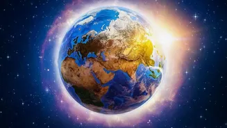
First, let's establish the baseline. For decades, the planet has been on a consistent warming trajectory. Human activities, primarily the burning of fossil fuels, have released greenhouse gases that trap heat in the atmosphere. This isn't a cyclical or temporary
phase; it's a long-term trend. According to scientific bodies like NOAA, the rate of warming has more than tripled since 1975, and the ten warmest years in recorded history have all occurred in the last decade. This continuous warming acts as a rising floor, elevating the starting point for any short-term weather phenomena. Think of it as a steadily rising tide; even small waves can now reach higher than ever before.
Enter El Niño: Nature's Great Disrupter
Layered on top of this long-term trend are natural cycles, the most influential of which is the El Niño-Southern Oscillation (ENSO). This is a recurring climate pattern involving changes in the temperature of waters in the central and eastern tropical Pacific Ocean. The cycle has two main phases: La Niña, a cooling phase, and El Niño, a warming phase. During an El Niño event, trade winds weaken, allowing warm water that is normally pushed toward Asia to shift eastward, toward the Americas. This release of vast amounts of ocean heat into the atmosphere doesn't just warm the Pacific; it disrupts weather patterns globally.
A Powerful Combination
El Niño itself does not cause long-term climate change. Instead, it acts as an amplifier. When an El Niño phase coincides with the already elevated baseline of global warming, it can push global temperatures into record-breaking territory. The phenomenon is like adding a powerful wave on top of that already rising tide. The excess heat released from the ocean temporarily supercharges the atmosphere, leading to some of the hottest years ever recorded. The strong El Niño events of 1997-98, 2015-16, and 2023-24 all resulted in subsequent years smashing global temperature records.
The Forecast for Early 2027
Climate prediction centers are currently observing the rapid development of a strong El Niño event. According to the latest forecasts from July 2026, there is an extremely high probability—over 90%—that strong El Niño conditions will persist through the end of 2026 and into early 2027. Some models project that this event could be among the strongest in the historical record. Because global air temperatures typically lag behind ocean warming by a few months, the peak impact of an El Niño that strengthens in late 2026 is expected to be felt in 2027. This has led climate scientists to project that 2027 has a very high chance of becoming the warmest year ever recorded, potentially being the first full year to breach critical warming thresholds.
What This Means for India
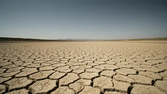
These global patterns have significant local consequences. For India, El Niño events are historically linked to a weakening of the vital southwest monsoon. The altered atmospheric circulation can disrupt normal rainfall patterns, leading to the potential for below-average precipitation and drought conditions in large parts of the country. This can impact agriculture, deplete reservoir levels, and affect the economy. Furthermore, the amplified warming can lead to more frequent and intense heatwaves across the subcontinent, posing serious risks to public health. While not every El Niño guarantees a poor monsoon, it significantly tilts the odds in that direction, making the forecast for 2027 a matter of national concern.