




Eyes in the Sky Watching Our Water
When we think of satellites, we might picture weather forecasts or GPS navigation. But some of the most important satellites flying hundreds of kilometres above us are tasked with a different mission: weighing the Earth’s water. Missions like NASA's Gravity
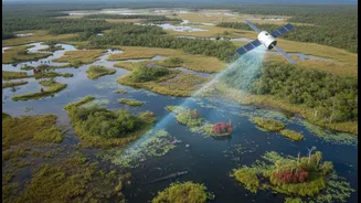
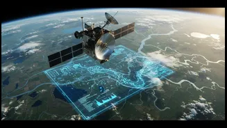
Recovery and Climate Experiment (GRACE) and the newer Surface Water and Ocean Topography (SWOT) are fundamentally changing our understanding of water. These are not cameras taking pictures of rivers; they are sophisticated instruments measuring the subtle shifts in our planet's water systems. They can detect changes in the volume of water stored in underground aquifers, the height of our rivers and lakes, and the moisture locked in the soil. This technology provides a global perspective on a local problem, allowing scientists and governments to see large-scale patterns that would be impossible to detect from the ground alone.
How Satellites See the Unseen
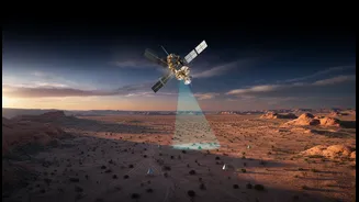
The technology sounds like science fiction, but the principle is surprisingly straightforward. The twin GRACE satellites, which operated from 2002 to 2017, and their successor, GRACE-FO, measure tiny variations in Earth’s gravity. Since water has mass, a region with more water exerts a slightly stronger gravitational pull. By flying in formation and precisely tracking the distance between them, the satellites can map where water is being gained or lost over time. This has proven incredibly effective for monitoring large, hidden resources like groundwater. The SWOT satellite, launched in late 2022, takes a different approach. It uses advanced radar technology to bounce signals off the planet's surface, creating highly detailed maps of the height and extent of rivers, lakes, and reservoirs. This gives us a clear picture of our visible water resources with an accuracy never before possible.
Detecting the Slow Creep of Crisis
The true power of this technology lies in its ability to reveal gradual changes that accumulate into a full-blown crisis. A perfect example is groundwater depletion. Across many parts of the world, including northern India, underground aquifers that supply water for farming and cities are being drained faster than they can be replenished. This is a slow, invisible process. By the time wells start running dry, the crisis is already severe. GRACE data has been able to quantify this depletion over the last two decades, showing a steady decline in groundwater storage in critical agricultural regions. Similarly, SWOT can monitor the gradual shrinking of reservoirs during a prolonged dry spell or track subtle changes in river flow, providing an early warning of an impending drought. This ability to spot a trend before it becomes a headline is revolutionary for disaster preparedness.
A New View for India's Water Future
For India, a country grappling with intense water stress, this technology is not just an academic curiosity; it is a vital tool for survival. With a significant portion of its agriculture dependent on groundwater, understanding the state of aquifers is critical. Data from GRACE has already confirmed alarming rates of groundwater loss in states like Punjab and Haryana. Indian institutions are taking note. ISRO's National Remote Sensing Centre is already using satellite data to map groundwater prospects to support national drinking water initiatives. Researchers are also exploring how to combine data from GRACE and SWOT to better manage major river basins like the Ganga-Brahmaputra. This can lead to more informed policies, helping authorities decide where to promote water conservation, invest in aquifer recharge projects, or implement more sustainable irrigation practices, protecting both livelihoods and lives.
From Data to Decisive Action
Of course, data alone cannot solve a water crisis. A satellite can show you that a problem is emerging, but it cannot force a change in policy or behaviour. The greatest challenge lies in bridging the gap between the information we have and the actions we take on the ground. This involves not just government policy but also community participation. For example, some initiatives in India train local villagers to monitor well levels themselves, creating a powerful combination of high-tech satellite overview and low-tech, on-the-ground knowledge. This builds local awareness and empowers communities to manage their own resources. The satellite data provides the large-scale context, confirming that local problems are part of a wider trend that requires a coordinated response. The path forward requires integrating this powerful satellite intelligence into every level of water governance, from national policy to village-level water management committees.