



A Lake Born from Disaster
On August 26, a catastrophic event unfolded on the Nepal-Tibet border when a huge mass of rock and glacial ice broke off a mountainside. The resulting avalanche, so powerful it registered as a magnitude 5.2 seismic event, slammed into the valley below,
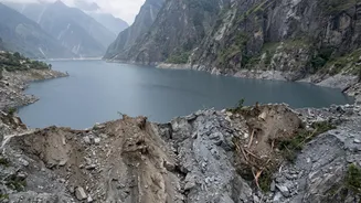
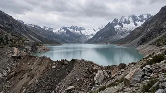
creating a devastating debris flow. This torrent of mud, rock, and water blocked the course of rivers in the area, including tributaries of the Gandak river system. As water backed up behind this naturally formed dam of debris, a new and dangerous 'barrier lake' was created. Chinese and Nepalese authorities quickly identified the new waterbody, which formed at the confluence of the Chhochen Khola and Purepu Tsangpo rivers, holding an estimated 2.5 million cubic metres of water.
The Science of a Ticking Time Bomb
Unlike a man-made reservoir with a reinforced concrete dam, a barrier lake is held back by a loose, unstable mix of rock, mud, and ice. This natural dam is incredibly fragile. It can be breached by several factors: the sheer pressure of the water building up behind it, erosion as the lake begins to overflow its top, or even another smaller landslide into the lake. If the dam fails, it won't be a gradual release. It would likely be a sudden, catastrophic collapse, unleashing the entire volume of the lake in a single, massive wave known as a Landslide Dam Outburst Flood (LDOF). This wall of water would rush downstream with immense force, picking up more debris and destroying everything in its path, giving communities very little time to react.
India's Downstream Danger Zone
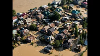
The threat doesn't stop at Nepal's border. The river system at the heart of this crisis is the Gandak, known as the Narayani River in Nepal. After crossing the border into India, the Gandak flows through large parts of Bihar and Uttar Pradesh before joining the Ganga. A sudden breach of the barrier lake would send a flood surge directly into these Indian states. Authorities have placed several districts on high alert, including West Champaran, East Champaran, Gopalganj, Muzaffarpur, and Vaishali in Bihar, as well as Maharajganj and Kushinagar in Uttar Pradesh. Officials are vigilantly monitoring water flow at key points like the Valmikinagar barrage in Bihar, which is the first point of contact for floodwaters entering India from Nepal.
A Region on High Alert
In response to the threat, both countries have taken urgent measures. In Nepal, residents in downstream areas were warned to move to higher ground, and rescue operations for the initial flood were temporarily halted as the new danger emerged. In India, National Disaster Response Force (NDRF) teams have been deployed to vulnerable areas, and district administrations are on standby for potential evacuations. The situation remains tense because of conflicting information and the difficulty of monitoring the remote, high-altitude location of the lake. Authorities are relying on satellite imagery and warnings from Chinese officials monitoring the lake on the Tibetan side of the border.
The New Normal in the Himalayas
This event is a stark reminder of the growing dangers in the Himalayan region. Climate change is accelerating glacier melt and thawing permafrost, making mountain slopes more unstable. This leads to an increase in landslides, avalanches, and the formation of glacial lakes, creating complex, cascading disasters that can cross international borders in minutes. This isn't an isolated incident; similar events have caused widespread destruction in recent years, including the 2021 disaster in Uttarakhand and the 2023 glacial lake outburst in Sikkim. For the millions living downstream in populous regions of India, these high-altitude threats are becoming an increasingly frequent and dangerous reality.