






A River's Fury Unleashed
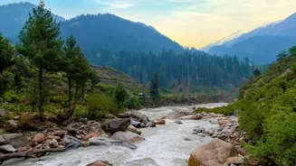
On the morning of August 26, a sudden surge of water, mud, and debris tore down the Bhotekoshi river valley in Nepal. Initially suspected to be a glacial lake outburst flood (GLOF), experts now believe the trigger was a catastrophic glacier collapse and subsequent
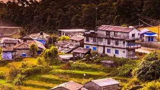
avalanche in the Himalayas near the Nepal-Tibet border. The wall of water, rising as much as nine metres in half an hour in some places, obliterated villages, hydropower projects, and critical infrastructure, including bridges that connect Nepal with China. The disaster has left hundreds dead and many more missing, including a significant number of foreign tourists and Indian nationals. Rescue efforts were immediately launched, but the scale of the devastation in the mountainous terrain has been immense, with Nepal requesting international assistance.
The Invisible Shield: A Lifeline for India
For Indian states like Bihar and Uttar Pradesh, a major flood in Nepal is a direct threat. Many of Nepal’s largest rivers, including the Kosi, Gandak, and Ghaghra, flow south into the densely populated Gangetic plain. Recognizing this shared vulnerability, India and Nepal have established a multi-layered cooperative framework over the years. This includes joint committees on water resources and flood management. A critical component of this cooperation is the Flood Forecasting and Early Warning System. Nepal's Department of Hydrology and Meteorology shares real-time data from hydro-meteorological stations in Nepalese catchments with India’s Central Water Commission (CWC). This data is crucial for the CWC's flood control rooms in Patna and Lucknow, allowing them to issue forecasts and alerts for downstream Indian communities.
The Critical Downstream Test
As the flood surge from the Bhotekoshi moved into the Trishuli and then the Gandak river systems, authorities in India were put on high alert. The CWC reported the sudden water rise in Nepal, warning that the surge could travel downstream into the Gandak river in India. This triggered a swift response. In Bihar, the administration began closely monitoring the Gandak, which was already flowing above the danger level in some areas. As a precaution, all 36 gates of the Gandak barrage at Valmiki Nagar were opened to manage the expected inflow, releasing around 150,000 cusecs of water. The National Disaster Response Force (NDRF) deployed 20 teams—11 in Uttar Pradesh and nine in Bihar—for potential evacuation and rescue operations.
Did the System Work?
The early warning information from Nepal appears to have provided Indian authorities with crucial lead time. The system of data sharing and alerts functioned as intended, allowing for preemptive measures like opening the barrage gates and deploying NDRF teams. As a result, the National Disaster Response Force reported that there was no adverse impact from the flash floods on the Indian side, despite the catastrophe upstream. While the situation was monitored closely, the preparedness measures helped mitigate the risk of flooding in the bordering districts of Bihar and Uttar Pradesh. This event underscored the absolute necessity of the cross-border data exchange; without it, the surge of water could have arrived with little to no warning, potentially causing significant damage in Indian territory.
Lessons from the Deluge
While the downstream warning system for India proved effective in this instance, the disaster in Nepal has exposed critical vulnerabilities, particularly concerning the origin of such floods. Experts noted that because the event was triggered across the border in Tibet, the warning time for communities in Nepal itself was tragically short—as little as seven minutes in some areas. This highlights a gap in the existing warning systems, which are often designed to monitor known glacial lakes within Nepal but are less effective against sudden avalanches or outbursts originating in another country. The incident serves as a powerful reminder that in an era of accelerating climate change, which makes Himalayan glaciers more unstable, strengthening regional cooperation to include China in a three-way data-sharing mechanism is more critical than ever. The Himalayas do not respect political borders, and effective disaster preparedness cannot afford to either.